
IMAGES TAKEN NEAR TO
Cortland Road, MIDDLESBROUGH, TS7 0JX
Introduction
This page details the photographs taken nearby to Cortland Road, TS7 0JX by members of the Geograph project.
The Geograph project started in 2005 with the aim of publishing, organising and preserving representative images for every square kilometre of Great Britain, Ireland and the Isle of Man.

There are currently over 7.5m images from over14,400 individuals and you can help contribute to the project by visiting https://www.geograph.org.uk
Image Map
Images are licensed for reuse under creativecommons.org/licenses/by-sa/2.0
Notes
- Clicking on the map will re-center to the selected point.
- The higher the marker number, the further away the image location is from the centre of the postcode.
Image Listing (19 Images Found)
Images are licensed for reuse under creativecommons.org/licenses/by-sa/2.0
Image
Details
Distance
3
Gypsy Lane
Southern end as it approaches Guisborough Road
Image: © Stephen McCulloch
Taken: 5 Feb 2008
0.13 miles
5
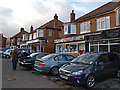
Nunthorpe Shops
Row of shops on Guisborough Road.
Image: © Stephen McCulloch
Taken: 27 Nov 2008
0.15 miles
7
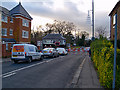
Waiting for a train
Level crossing on Guisborough Road
Image: © Stephen McCulloch
Taken: 27 Nov 2008
0.18 miles
9
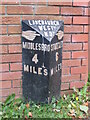
Old milepost
This milepost cast at the Mattison of Bedale foundry in the late 19C is now outside 17, Gypsy Lane in Nunthorpe. It has been moved from what is now A172 Dixon's Bank/Stokesley Road and is noted on the 1912 OS 6" map. NZ 5185 1541. All the other posts still in situ from this foundry are now painted black letters and hands on white but it is not known what was the original livery.
Image: © Mike Rayner
Taken: 14 Sep 2019
0.20 miles
10
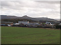
View across fields to Nunthorpe School
Taken from Rothesay Grove just outside of the gridsquare.
Roseberry Topping is the prominent hill in the distance.
Image: © Stephen McCulloch
Taken: 5 Feb 2008
0.20 miles