
IMAGES TAKEN NEAR TO
Bessemer Court, MIDDLESBROUGH, TS6 7EB
Introduction
This page details the photographs taken nearby to Bessemer Court, TS6 7EB by members of the Geograph project.
The Geograph project started in 2005 with the aim of publishing, organising and preserving representative images for every square kilometre of Great Britain, Ireland and the Isle of Man.

There are currently over 7.5m images from over14,400 individuals and you can help contribute to the project by visiting https://www.geograph.org.uk
Image Map
Images are licensed for reuse under creativecommons.org/licenses/by-sa/2.0
Notes
- Clicking on the map will re-center to the selected point.
- The higher the marker number, the further away the image location is from the centre of the postcode.
Image Listing (12 Images Found)
Images are licensed for reuse under creativecommons.org/licenses/by-sa/2.0
Image
Details
Distance
1
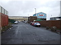
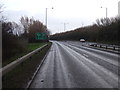
Lee Road looking north
Now bisected by the A66.
Image: © JThomas
Taken: 25 Jan 2014
0.09 miles
2
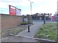
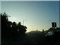
Cyclist and pedestrian cut-through
Leading from Lee Road, Grangetown onto the A66.
Image: © Oliver Dixon
Taken: 21 Mar 2017
0.12 miles
3
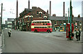
British Trolleybus - Teesside
The Teesside Railless Traction Board was a jointly owned operation involving Middlesbrough Corporation and Eston Urban District Council, principally to link the local steelworks with residential areas. Grangetown was the original eastern terminus of the system until later housing estates were developed.
This shows the old centre of Grangetown, Grangetown Square, with the tall chimneys of the Dorman Long steelworks behind.
Practically nothing of the 'permanent' buildings, structures and roads remains today. The Victorian housing has disappeared and been replaced by light industrial development with a significantly different road pattern. The chimneys are also gone, although the large shed just visible at the end of the street was still visible on satellite views at the time the picture was added to Geograph.
The trolleybus in the picture is a stranger in town. It is a preserved and restored vehicle from the former Brighton Hove and District company which was operating a tour for trolleybus enthusiasts. Towards the end of trolleybus operation in the UK many of the remaining systems allowed enthusiasts to bring preserved vehicles to operate on special occasions. By the time of this picture the section of wiring in Grangetown Square was no longer in use by regular services.
Image: © Alan Murray-Rust
Taken: 31 Mar 1968
0.13 miles
6
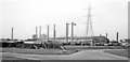
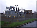
Steelworks in South Bank - Grangetown area, 1961
View believed to be NW from Tees Dock Road, near Grangetown station, but - [There has been so much change here in the ensuing 50-60 years, that locating this scene at all precisely is very difficult!]
Image: © Ben Brooksbank
Taken: 19 Apr 1961
0.18 miles
8
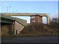
Old signal cabin
Formerly serving a part of the steelworks railway network rendered redundant by the closure of the South Bank works.
Image: © Alan Murray-Rust
Taken: 9 Feb 2010
0.21 miles
9
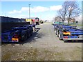
West Lane, Grangetown
Part of an industrial estate on the north side of the A66.
Image: © Oliver Dixon
Taken: 21 Mar 2017
0.23 miles
10
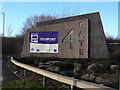
4 GATE
Entrance to Teesport off the A66 at Grangetown.
Image: © Alan Murray-Rust
Taken: 9 Feb 2010
0.23 miles