IMAGES TAKEN NEAR TO
Argyle Road, MIDDLESBROUGH, TS6 7DH

Introduction

This page details the photographs taken nearby to Argyle Road, TS6 7DH by members of the Geograph project.

The Geograph project started in 2005 with the aim of publishing, organising and preserving representative images for every square kilometre of Great Britain, Ireland and the Isle of Man.

There are currently over 7.5m images from over14,400 individuals and you can help contribute to the project by visiting https://www.geograph.org.uk

Image Map


Images are licensed for reuse under creativecommons.org/licenses/by-sa/2.0
Notes
  • Clicking on the map will re-center to the selected point.
  • The higher the marker number, the further away the image location is from the centre of the postcode.

Image Listing (7 Images Found)

Images are licensed for reuse under creativecommons.org/licenses/by-sa/2.0
Image
Details
Distance
1
A66 at Whitworth Road lights
Image: © Colin Pyle Taken: 2 Nov 2015
0.18 miles
2
Cyclist and pedestrian cut-through
Leading from Lee Road, Grangetown onto the A66.
Image: © Oliver Dixon Taken: 21 Mar 2017
0.21 miles
3
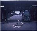
A Trolleybus under the bridge at Grangetown
Taken in July 1970, this photo shows a Sunbeam F4 trolleybus 4 (GAJ 14) with Roe 61-seater bodywork on a private tour of the area's trolleybus system going under a railway bridge in Bolckow Road near the junction with Eston Road. This bridge carried the Bolckow Vaughan Private Railway to the Dorman Long steelworks nearby, but has long since been dismantled and the whole area is completely different today.
Image: © David Hillas Taken: 18 Jul 1970
0.23 miles
4
No room to spare. A Teesside trolleybus on Bolckow Road, Grangetown ? 1971
Just inches to spare under the bridge which carry the internal railway of the South Bank Ironworks. The bridge has disappeared almost without trace, with just some of the retaining walls remaining. This is one of a series of views featuring buses in the 60s, 70s, and 80s. http://www.geograph.org.uk/search.php?i=2114547&displayclass=slide
Image: © Alan Murray-Rust Taken: 23 Mar 1971
0.23 miles
5
Lee Road looking north
Now bisected by the A66.
Image: © JThomas Taken: 25 Jan 2014
0.24 miles
6
West Lane, Grangetown
Part of an industrial estate on the north side of the A66.
Image: © Oliver Dixon Taken: 21 Mar 2017
0.24 miles
7
A66 heading east
Image: © JThomas Taken: 25 Jan 2014
0.25 miles