IMAGES TAKEN NEAR TO
Enterprise Court, MIDDLESBROUGH, TS6 6TL
Introduction
This page details the photographs taken nearby to Enterprise Court, TS6 6TL by members of the Geograph project.
The Geograph project started in 2005 with the aim of publishing, organising and preserving representative images for every square kilometre of Great Britain, Ireland and the Isle of Man.

There are currently over 7.5m images from over14,400 individuals and you can help contribute to the project by visiting https://www.geograph.org.uk
Image Map
Images are licensed for reuse under creativecommons.org/licenses/by-sa/2.0
Notes
- Clicking on the map will re-center to the selected point.
- The higher the marker number, the further away the image location is from the centre of the postcode.
Image Listing (41 Images Found)
Images are licensed for reuse under creativecommons.org/licenses/by-sa/2.0
Image
Details
Distance
3
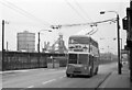
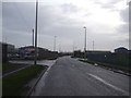
Middlesbrough Road, South Bank ? 1971
This section of Middlesbrough Road has been completely obliterated by the construction of the current A66.
Classic South Bank ironworks scenery, including gasholder and blast furnace, with a Teesside trolleybus on the final day of trolleybus operation.
Trolleybus T291 was one of 5 bought second-hand from Reading in 1969 to shore up the ageing fleet. It is a Sunbeam F4A with Burlingham bodywork, new in 1961.
This is one of a series of views featuring buses in the 60s, 70s, and 80s. http://www.geograph.org.uk/search.php?i=137652761
Image: © Alan Murray-Rust
Taken: 4 Apr 1971
0.06 miles
5
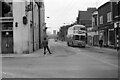
Crossroads, South Bank ? 1971
Middlesbrough Road at Normanby Road. Today, this bit of Middlesbrough Road effectively no longer exists as a result of its replacement by the modern A66 https://www.geograph.org.uk/photo/145693 . All the buildings on the right hand side have been demolished. On the left the double doors are the entrance to the local Post Office and Savings Bank, built into what had been the Workers' Institute.
The view was taken on the last day of operation of trolleybuses on Teesside. Trolleybus T291 was one of 5 bought second-hand from Reading in 1969 to shore up the ageing fleet. It is a Sunbeam F4A with Burlingham bodywork, new in 1961.
This is one of a series of views featuring buses in the 60s, 70s, and 80s. http://www.geograph.org.uk/search.php?i=137652761
Image: © Alan Murray-Rust
Taken: 3 Apr 1971
0.06 miles
6
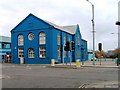
Former Public Building, South Bank
Former workers institute.
Image: © Mick Garratt
Taken: 20 Mar 2006
0.07 miles
7
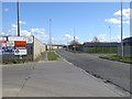
Diversion along Puddler's Road
This dreary stretch of road through an industrial area is part of the diversion of the Teesdale Way and England Coast Path necessitated by the closure of a 2 km section of the Black Path since November 2015 during the decommissioning of the old Sahaviriya Steel Industries (SSI) site (see Image). The diversion adds a further 2 km to the total length of the path.
Image: © Oliver Dixon
Taken: 21 Mar 2017
0.07 miles
8
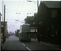
Tees-side trolleybus at Bennett's Corner
Sunbeam F4 trolleybus 4 (GAJ 14) in Middlesbrough Road, South Bank, having crossed Normanby Road on the right, where the trolleybus route to Normanby branched off. The trolleybus route to Grangetown went on straight ahead.
Image: © David Hillas
Taken: 18 Jul 1970
0.08 miles
9
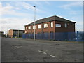
P D Transport premises in Middlesbrough
Image: © Peter Robinson
Taken: 30 Oct 2011
0.08 miles