IMAGES TAKEN NEAR TO
The Lawns, MIDDLESBROUGH, TS4 3FA
Introduction
This page details the photographs taken nearby to The Lawns, TS4 3FA by members of the Geograph project.
The Geograph project started in 2005 with the aim of publishing, organising and preserving representative images for every square kilometre of Great Britain, Ireland and the Isle of Man.

There are currently over 7.5m images from over14,400 individuals and you can help contribute to the project by visiting https://www.geograph.org.uk
Image Map
Images are licensed for reuse under creativecommons.org/licenses/by-sa/2.0
Notes
- Clicking on the map will re-center to the selected point.
- The higher the marker number, the further away the image location is from the centre of the postcode.
Image Listing (5 Images Found)
Images are licensed for reuse under creativecommons.org/licenses/by-sa/2.0
Image
Details
Distance
1
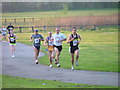
Stewart Park
The former grounds of Marton Hall. Viewed here on the occasion of an evening road race, one of the Tees Forest series.
Image: © Mick Garratt
Taken: 21 Apr 2005
0.15 miles
2
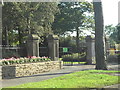
Stewart Park Entrance
Councillor Thomas D Stewart gave the park to the people of Middlesbrough in 1928. The site of the cottage where Captain James Cook was born is in the park.
Image: © Darren Haddock
Taken: 9 Sep 2006
0.16 miles
3
Playing Fields
Playing fields for Marton Road School.
Image: © Darren Haddock
Taken: 9 Sep 2006
0.17 miles
4
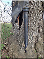
Ash Tree, Stewarts Park
Not sure what the pipe is for. Presumably a stench pipe, a vent for an underground sewer pipe. The steel mesh is I guess an attempt to stop the hollow ash tree from being used as a rubbish bin. This has not been successful and the old tree has been subject to fires lit in its trunk. But it survives but I suppose it'll now have to fight ash die back disease.
Image: © Mick Garratt
Taken: 3 Apr 2016
0.24 miles