IMAGES TAKEN NEAR TO
Hartbushes, WINGATE, TS28 5GA
Introduction
This page details the photographs taken nearby to Hartbushes, TS28 5GA by members of the Geograph project.
The Geograph project started in 2005 with the aim of publishing, organising and preserving representative images for every square kilometre of Great Britain, Ireland and the Isle of Man.

There are currently over 7.5m images from over14,400 individuals and you can help contribute to the project by visiting https://www.geograph.org.uk
Image Map
Images are licensed for reuse under creativecommons.org/licenses/by-sa/2.0
Notes
- Clicking on the map will re-center to the selected point.
- The higher the marker number, the further away the image location is from the centre of the postcode.
Image Listing (3 Images Found)
Images are licensed for reuse under creativecommons.org/licenses/by-sa/2.0
Image
Details
Distance
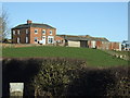
1
Assorted farming initiatives, Hutton Henry
Image: © Oliver Dixon
Taken: 14 Nov 2006
0.12 miles
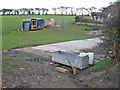
2
View towards Fairfield
A bright clear evening in Hutton Henry.
Image: © Richard Webb
Taken: 22 May 2016
0.15 miles