
IMAGES TAKEN NEAR TO
Coast Road, HARTLEPOOL, TS27 4AQ
Introduction
This page details the photographs taken nearby to Coast Road, TS27 4AQ by members of the Geograph project.
The Geograph project started in 2005 with the aim of publishing, organising and preserving representative images for every square kilometre of Great Britain, Ireland and the Isle of Man.

There are currently over 7.5m images from over14,400 individuals and you can help contribute to the project by visiting https://www.geograph.org.uk
Image Map
Images are licensed for reuse under creativecommons.org/licenses/by-sa/2.0
Notes
- Clicking on the map will re-center to the selected point.
- The higher the marker number, the further away the image location is from the centre of the postcode.
Image Listing (11 Images Found)
Images are licensed for reuse under creativecommons.org/licenses/by-sa/2.0
Image
Details
Distance
4
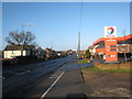
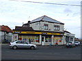
TOTAL filling station at Blackhall Colliery
This photograph shows a view of the TOTAL filling station on the A1086 at Blackhall Colliery. The photograph was taken looking in a northerly direction from Glenholme Terrace. The junction of the B1281 with the A1086 can just be seen beyond the traffic island.
Image: © Philip Barker
Taken: 17 Jan 2010
0.18 miles
7
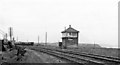
Site of Blackhall Rocks Station
View NW, towards Sunderland; Northallereton/Middlesbrough - Stockton - Sunderland - Newcastle secondary main line. Station closed to passengers 4/1/60, goods 7/12/64.
Image: © Ben Brooksbank
Taken: 6 Sep 1970
0.21 miles
8
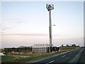
Communication mast at Mickle Hill
This photograph shows a view of the communication mast located on Mickle Hill near Blackhall Rocks. This picture was taken looking along the Mickle Hill road in a north-easterly direction towards the A1086 road.
Image: © Philip Barker
Taken: 17 Jan 2010
0.24 miles
9
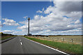
Mickle Hill Road
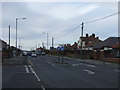
The urban developments along the Coast Road are soon left behind as the road heads out into the country.
Image: © Des Blenkinsopp
Taken: 21 Aug 2022
0.25 miles
10
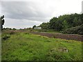
Blackhall Rocks railway station (site), County Durham
Opened in 1904 by the North Eastern Railway on its line from Stockton to Sunderland, this station closed in 1964 and was subsequently demolished. It had never had a frequent service, being aimed mainly at tourists, services in the early years were concentrated on just two days per week.
View south east towards Hart and Stockton. The two parallel platforms were in the centre of the image with a small building being located where the "box" to the right of the track now is.
Image taken through the track-side fencing.
Image: © Nigel Thompson
Taken: 1 Aug 2020
0.25 miles