IMAGES TAKEN NEAR TO
Cairn Road, HARTLEPOOL, TS25 3AQ
Introduction
This page details the photographs taken nearby to Cairn Road, TS25 3AQ by members of the Geograph project.
The Geograph project started in 2005 with the aim of publishing, organising and preserving representative images for every square kilometre of Great Britain, Ireland and the Isle of Man.

There are currently over 7.5m images from over14,400 individuals and you can help contribute to the project by visiting https://www.geograph.org.uk
Image Map
Images are licensed for reuse under creativecommons.org/licenses/by-sa/2.0
Notes
- Clicking on the map will re-center to the selected point.
- The higher the marker number, the further away the image location is from the centre of the postcode.
Image Listing (8 Images Found)
Images are licensed for reuse under creativecommons.org/licenses/by-sa/2.0
Image
Details
Distance
1

Ordnance Survey Cut Mark
This OS cut mark can be found on No83 Owton Manor Lane. It marks a point 17.953m above mean sea level.
Image: © Adrian Dust
Taken: 2 Sep 2025
0.09 miles
2
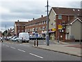
Owton Manor Lane shopping precinct, Hartlepool
Image: © Oliver Dixon
Taken: 6 Jul 2016
0.10 miles
3
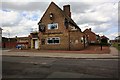
The Rossmere hostelry
This photograph shows a view of The Rossmere hostelry in Owton Manor Lane in the Owton Manor area of Hartlepool. The picture was taken looking in a northerly direction towards Wynyard Road.
Image: © Philip Barker
Taken: 28 May 2010
0.17 miles
4

Ordnance Survey Cut Mark
This OS cut mark can be found on No319 Catcote Road. It marks a point 18.882m above mean sea level.
Image: © Adrian Dust
Taken: 2 Sep 2025
0.20 miles
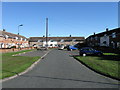
6
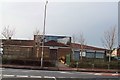
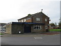
Owton Manor Baptist Church
Originally a tin church it has been extended three times and a car park added too.
Image: © Colin Coates
Taken: 4 Dec 2005
0.24 miles