IMAGES TAKEN NEAR TO
Jones Road, HARTLEPOOL, TS24 9BD
Introduction
This page details the photographs taken nearby to Jones Road, TS24 9BD by members of the Geograph project.
The Geograph project started in 2005 with the aim of publishing, organising and preserving representative images for every square kilometre of Great Britain, Ireland and the Isle of Man.

There are currently over 7.5m images from over14,400 individuals and you can help contribute to the project by visiting https://www.geograph.org.uk
Image Map
Images are licensed for reuse under creativecommons.org/licenses/by-sa/2.0
Notes
- Clicking on the map will re-center to the selected point.
- The higher the marker number, the further away the image location is from the centre of the postcode.
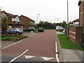
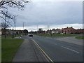
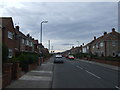
Image Listing (11 Images Found)
Images are licensed for reuse under creativecommons.org/licenses/by-sa/2.0
Image
Details
Distance
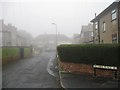
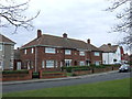
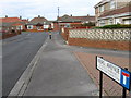
4
Jones Road and Lightfoot Crescent
At the top of Jones Road, looking along Lightfoot Crescent towards its junction with Easington Road
Image: © Jamie Percival
Taken: 28 May 2010
0.14 miles
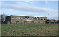
7
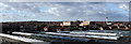
University Hospital of Hartlepool
Taken from the roof of SCA Packaging looking West towards the Hospital with wind turbines at Hart Village in the distance
Image: © George Ford
Taken: 16 May 2004
0.22 miles