
IMAGES TAKEN NEAR TO
Lizard Walk, HARTLEPOOL, TS24 7HX
Introduction
This page details the photographs taken nearby to Lizard Walk, TS24 7HX by members of the Geograph project.
The Geograph project started in 2005 with the aim of publishing, organising and preserving representative images for every square kilometre of Great Britain, Ireland and the Isle of Man.

There are currently over 7.5m images from over14,400 individuals and you can help contribute to the project by visiting https://www.geograph.org.uk
Image Map
Images are licensed for reuse under creativecommons.org/licenses/by-sa/2.0
Notes
- Clicking on the map will re-center to the selected point.
- The higher the marker number, the further away the image location is from the centre of the postcode.
Image Listing (34 Images Found)
Images are licensed for reuse under creativecommons.org/licenses/by-sa/2.0
Image
Details
Distance
4
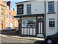
Princess Helena, Whitby Street, Hartlepool
Image: © Alex McGregor
Taken: 4 Oct 2010
0.19 miles
5
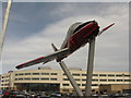
RAF Jet Provost T5 serial XW405
Ex-RAF Jet Provost T5 serial XW405 was stripped, repainted and rebuilt by students and staff of Hartlepool College. It retains the red, white and grey colours of the RAF Flight Training School circa late 1980s and forms a gateway to the College.
Image: © Dave Pickersgill
Taken: 19 Mar 2014
0.19 miles
6
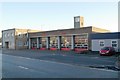
Stranton fire station
Stranton fire station, Stockton Street, Hartlepool, Cleveland
Image: © Kevin Hale
Taken: 27 Nov 2006
0.19 miles
7
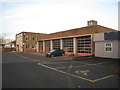
Fire Station, Stockton Street, Hartlepool
Image: © Jonathan Thacker
Taken: 29 Nov 2012
0.20 miles
9
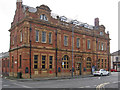
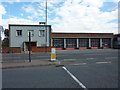
Hartlepool - former post office on Whitby Street
Image: © Dave Bevis
Taken: 31 May 2014
0.21 miles
10
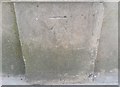
Ordnance Survey Cut Mark
This OS cut mark can be found on the east face of the old Co-op Building. It marks a point 9.367m above mean sea level.
Image: © Adrian Dust
Taken: 17 Sep 2018
0.22 miles