IMAGES TAKEN NEAR TO
Sidings Close, HARTLEPOOL, TS24 7AQ
Introduction
This page details the photographs taken nearby to Sidings Close, TS24 7AQ by members of the Geograph project.
The Geograph project started in 2005 with the aim of publishing, organising and preserving representative images for every square kilometre of Great Britain, Ireland and the Isle of Man.

There are currently over 7.5m images from over14,400 individuals and you can help contribute to the project by visiting https://www.geograph.org.uk
Image Map
Images are licensed for reuse under creativecommons.org/licenses/by-sa/2.0
Notes
- Clicking on the map will re-center to the selected point.
- The higher the marker number, the further away the image location is from the centre of the postcode.
Image Listing (61 Images Found)
Images are licensed for reuse under creativecommons.org/licenses/by-sa/2.0
Image
Details
Distance
1
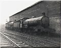
West Hartlepool locomotive shed
Two former NER, Q6 locomotives stand outside in the rain.
Image: © Roger Cornfoot
Taken: Unknown
0.04 miles
2
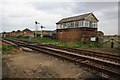
Railway and signal box in Old Town
This photograph shows a view of the railway line and signal box in the Old Town area of Hartlepool. The picture was taken from near the A178 road (behind the photographer) looking in a north-easterly direction towards The Headland.
Image: © Philip Barker
Taken: 29 May 2010
0.06 miles
3
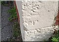
Ordnance Survey Cut Mark
This OS cut mark can be found on No9 Surtees Street, an Art Studio. It marks a point 5.877m above mean sea level.
Image: © Adrian Dust
Taken: 17 Sep 2018
0.06 miles
5
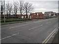
Hartlepool West 1st railway station (site), County Durham
Opened in 1841 by the Stockton & Hartlepool Railway in Mainsforth Terrace, this terminus station was renamed West Hartlepool in 1848 and closed to passengers in 1880 when it was replaced by the current station. It continued for many more years as a goods station.
View south along Mainsforth Terrace. The station building fronted the street where the flat roofed building now is.
Image: © Nigel Thompson
Taken: 1 Jan 2015
0.07 miles
6
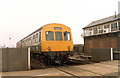
Class 101 DMU British Rail Regional Railways passing over railway crossing in Hartlepool, April 1986.
Image: © Martin Routledge
Taken: Unknown
0.10 miles
9
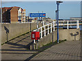
Signposts at the north end of the Esplanade
The splendid broad Esplanade from Seaton Carew to Hartlepool comes to an end here and walkers and cyclists must divert through the new housing development to the south of the Hartlepool Marina.
The small inconspicuous brown sign labelled "ECP" refers to the England Coast Path. This is a project being undertaken by Natural England to create a continuous National Trail round the entire coast of England which will allow users to enjoy the newly constituted right of access to the entire coast of England. The section between Seaton Carew and Sunderland has been completed; completion of the entire project is scheduled for 2020.
Image: © Oliver Dixon
Taken: 19 Nov 2015
0.11 miles