
IMAGES TAKEN NEAR TO
Fish Quay, HARTLEPOOL, TS24 0JH
Introduction
This page details the photographs taken nearby to Fish Quay, TS24 0JH by members of the Geograph project.
The Geograph project started in 2005 with the aim of publishing, organising and preserving representative images for every square kilometre of Great Britain, Ireland and the Isle of Man.

There are currently over 7.5m images from over14,400 individuals and you can help contribute to the project by visiting https://www.geograph.org.uk
Image Map
Images are licensed for reuse under creativecommons.org/licenses/by-sa/2.0
Notes
- Clicking on the map will re-center to the selected point.
- The higher the marker number, the further away the image location is from the centre of the postcode.
Image Listing (74 Images Found)
Images are licensed for reuse under creativecommons.org/licenses/by-sa/2.0
Image
Details
Distance
1
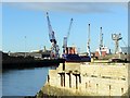
Victoria Harbour, Hartlepool
The cargo freighter, 'Beluga Fighter' is moored at Irvine's Quay. The photograph was taken from the west end of the Town Wall road that runs along the south side of Hartlepool Headland close to the site of the old ferry crossing to Middleton.
The ferry operated from 1854 to 1952 using 35 feet (10.6 metres) long passenger boats. The last ferry stopped soon after the death of the ferryman, Bill Boagey, who slipped on the ferry steps. The ferry was an important means of transport for Hartlepool folk employed in the boat yards on Middleton beach in the late 1800s. Middleton village itself has now been demolished.
Image: © Andrew Curtis
Taken: 4 Dec 2009
0.05 miles
2
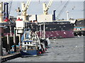
Boats at the Fish Quay
In Victoria Harbour, Hartlepool. The usual crowd of gulls around the fishing boats.
Image: © Robert Graham
Taken: 13 Feb 2012
0.06 miles
3
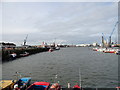
Hartlepool Fish Quay
This is at the eastern side of Victoria Harbour, on the Headland. The quay is on the left hand side of the picture.
Image: © Robert Graham
Taken: 13 Feb 2012
0.06 miles

5
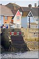
Steps Down to the Sea
Looking across the Commissioners' Harbour from Irvines Quay towards the Town Wall.
Image: © Mick Garratt
Taken: 8 Aug 2010
0.08 miles
6

Town Wall, Hartlepool Headland
The old ferry jetty is on the right Image
Image: © Andrew Curtis
Taken: 4 Dec 2009
0.08 miles
7
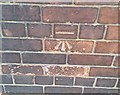
Ordnance Survey Cut Mark
This OS cut mark can be found on the wall NE side of Southgate. It marks a point 4.642m above mean sea level.
Image: © Adrian Dust
Taken: 17 Sep 2018
0.09 miles
8
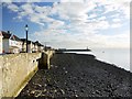
Stony beach below the Town Wall sea defences
Looking towards the Pilot's Pier lighthouse.
Image: © Andrew Curtis
Taken: 4 Dec 2009
0.10 miles
9
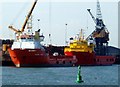
Hartlepool Docks
Offshore industry supply vessels berthed in Hartlepool Docks.
Image: © Martin Routledge
Taken: 12 Sep 2005
0.10 miles
10
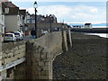
Town Wall at Croft on Heugh, Hartlepool
Image: © Mat Fascione
Taken: 26 Aug 2017
0.11 miles