
IMAGES TAKEN NEAR TO
Beamish Road, BILLINGHAM, TS23 3DT
Introduction
This page details the photographs taken nearby to Beamish Road, TS23 3DT by members of the Geograph project.
The Geograph project started in 2005 with the aim of publishing, organising and preserving representative images for every square kilometre of Great Britain, Ireland and the Isle of Man.

There are currently over 7.5m images from over14,400 individuals and you can help contribute to the project by visiting https://www.geograph.org.uk
Image Map
Images are licensed for reuse under creativecommons.org/licenses/by-sa/2.0
Notes
- Clicking on the map will re-center to the selected point.
- The higher the marker number, the further away the image location is from the centre of the postcode.
Image Listing (5 Images Found)
Images are licensed for reuse under creativecommons.org/licenses/by-sa/2.0
Image
Details
Distance
1
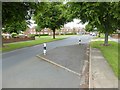
Low Grange Avenue, Billingham
This road carries National Cycle Network route 14 through the eastern suburbs of Billingham. There are a number of traffic-calming chicanes along the route.
Image: © Oliver Dixon
Taken: 6 Jul 2016
0.11 miles
2
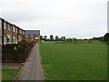
Housing on the edge of the common
These few houses on the outskirts of Billingham back straight on to the nature reserve around Cowpen Bewley.
Image: © DS Pugh
Taken: 5 Aug 2006
0.16 miles
3
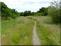
Old cycle path on the edge of Billigham
This cycle path, formerly part of National Cycle Network route 14 appears to have been superseded by a more roundabout route on better roads. But the signs are still in place. Comparison with Image demonstrates a decline in usage.
Image: © Oliver Dixon
Taken: 6 Jul 2016
0.21 miles
4
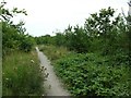
Sustrans Route 14 - Billingham
Running between the railway line and the school, this section of the route runs through a pleasant nature reserve.
Image: © DS Pugh
Taken: 5 Aug 2006
0.22 miles
5
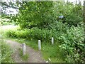
Old cycle path on the edge of Billingham
This cycle path, formerly part of National Cycle Network route 14, appears to have been superseded by a more roundabout route on better roads. But the signs are still in place.
Image: © Oliver Dixon
Taken: 6 Jul 2016
0.24 miles