
IMAGES TAKEN NEAR TO
The Pippins, BILLINGHAM, TS22 5QB
Introduction
This page details the photographs taken nearby to The Pippins, TS22 5QB by members of the Geograph project.
The Geograph project started in 2005 with the aim of publishing, organising and preserving representative images for every square kilometre of Great Britain, Ireland and the Isle of Man.

There are currently over 7.5m images from over14,400 individuals and you can help contribute to the project by visiting https://www.geograph.org.uk
Image Map
Images are licensed for reuse under creativecommons.org/licenses/by-sa/2.0
Notes
- Clicking on the map will re-center to the selected point.
- The higher the marker number, the further away the image location is from the centre of the postcode.
Image Listing (18 Images Found)
Images are licensed for reuse under creativecommons.org/licenses/by-sa/2.0
Image
Details
Distance

2
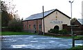
Wolviston Village Community Centre, West Hartlepool Road
Image: © Mick Garratt
Taken: 23 Nov 2006
0.07 miles
3
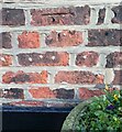
Wolviston, 46 High Street
The benchmark is cut into the west face of the property, and is cut across the 5th and 6th brick courses.
Image: © Mel Towler
Taken: 21 Jan 2023
0.08 miles
4
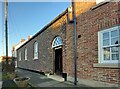
Wolviston, 46 High Street
There is a benchmark cut into the west face of the property, and the mark is cut across the 5th and 6th brick courses.
Image: © Mel Towler
Taken: 21 Jan 2023
0.08 miles
5

Footpath Between the Church and the High Street, Wolviston
Image: © Mick Garratt
Taken: 23 Nov 2006
0.09 miles

7
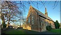
Wolviston, St Peter's church
There is a damaged benchmark cut into the west facing wall, the gable end of the church.
Image: © Mel Towler
Taken: 21 Jan 2023
0.09 miles
8
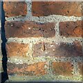
Wolviston, St Peter's church
The damaged benchmark is cut into the west facing wall, the gable end of the church.
Image: © Mel Towler
Taken: 21 Jan 2023
0.09 miles
9
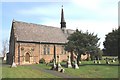
St Peter's Church in Wolviston
This photograph shows a view of the impressive 'spired' church located in the north-eastern area of the village of Wolviston. The picture was taken looking in a northerly direction towards the (old) A19 road.
Image: © Philip Barker
Taken: 17 Apr 2010
0.10 miles
10
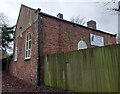
Wolviston, Cattery
There is a flush bracket [S8811] fixed into the east face of Wolviston Cattery. In the picture it is on the right hand side of the gable end wall and embedded into the 5th and 6th brick courses. The building was previously the Methodist chapel.
Image: © Mel Towler
Taken: 29 Dec 2021
0.10 miles