
IMAGES TAKEN NEAR TO
Port Clarence Road, MIDDLESBROUGH, TS2 1SF
Introduction
This page details the photographs taken nearby to Port Clarence Road, TS2 1SF by members of the Geograph project.
The Geograph project started in 2005 with the aim of publishing, organising and preserving representative images for every square kilometre of Great Britain, Ireland and the Isle of Man.

There are currently over 7.5m images from over14,400 individuals and you can help contribute to the project by visiting https://www.geograph.org.uk
Image Map
Images are licensed for reuse under creativecommons.org/licenses/by-sa/2.0
Notes
- Clicking on the map will re-center to the selected point.
- The higher the marker number, the further away the image location is from the centre of the postcode.
Image Listing (118 Images Found)
Images are licensed for reuse under creativecommons.org/licenses/by-sa/2.0
Image
Details
Distance
1
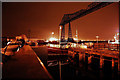
Transporter bridge at night
The Middlesbrough Transporter Bridge is the furthest downstream bridge across the River Tees. It connects Middlesbrough on the south bank to Port Clarence on the north bank. It is a transporter bridge, carrying a travelling 'car' or 'gondola' suspended from the bridge, across the river in 90 seconds. The car can carry 200 people, 9 cars, or 6 cars and one minibus. It carries the A178 road from Middlesbrough to Hartlepool.
Image: © philld
Taken: 21 Sep 2008
0.02 miles

4
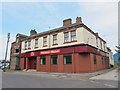
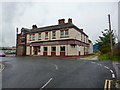
The Station Hotel, Port Clarence Road, TS2
Image: © Mike Quinn
Taken: 17 Jun 2013
0.05 miles
6
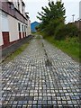
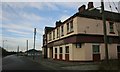
Backstreet at the side of the Station Hotel, Port Clarence Road
Image: © Alexander P Kapp
Taken: 23 Aug 2011
0.05 miles
7
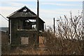
Derelict Signal Box, Port Clarence
At what would have been the east end of the old station.
Image: © Mick Garratt
Taken: 1 Feb 2007
0.06 miles

9
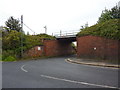
Railway bridge over Port Clarence Road
Image: © Alexander P Kapp
Taken: 23 Aug 2011
0.07 miles
10
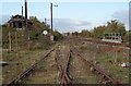
Disused railway lines above A178
Two sets of railway lines cross the A178 by a bridge the location of which is shown by the tubular railing. The disused railway lines branch further behind the camera position; they're well rusted and can have seen no use for some time. The rails to the right are polished and soon curve northwards towards industrial sites. The signal box at the left side of the image has been burnt out.
Image: © Trevor Littlewood
Taken: 17 Oct 2011
0.07 miles