
IMAGES TAKEN NEAR TO
Wilfred Whitfield Way, MIDDLESBROUGH, TS2 1EN
Introduction
This page details the photographs taken nearby to Wilfred Whitfield Way, TS2 1EN by members of the Geograph project.
The Geograph project started in 2005 with the aim of publishing, organising and preserving representative images for every square kilometre of Great Britain, Ireland and the Isle of Man.

There are currently over 7.5m images from over14,400 individuals and you can help contribute to the project by visiting https://www.geograph.org.uk
Image Map
Images are licensed for reuse under creativecommons.org/licenses/by-sa/2.0
Notes
- Clicking on the map will re-center to the selected point.
- The higher the marker number, the further away the image location is from the centre of the postcode.
Image Listing (28 Images Found)
Images are licensed for reuse under creativecommons.org/licenses/by-sa/2.0
Image
Details
Distance
2
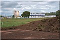
Contractor's Site Cabins
Work has just started on the new access into Riverside Park and North Middlesbrough from the A66 at Newport island. The route has been set out and the site cleared and topsoil stripped. The contractor's cabins have been set up and the compound is currently being fenced off. The cooling towers in the distance are on the north bank of the Tees.
Image: © Mick Garratt
Taken: 10 Jul 2008
0.07 miles
3
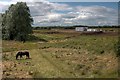
Construction of New Access Road into North Middlesbrough
Work has just started on the new access into Riverside Park and North Middlesbrough from the A66 at Newport island. The route has been set out and the site cleared and topsoil stripped. The contractor's cabins have been set up and the compound is currently being fenced off. National Cycleway Route 1 passes alongside the proposed route. It can be seen just in front of the cleared area.
Image: © Mick Garratt
Taken: 10 Jul 2008
0.09 miles
4
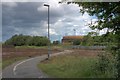
Construction of New Access Road into North Middlesbrough
Work has just started on the new access into Riverside Park and North Middlesbrough from the A66 at Newport island. The route has been set out and the site cleared and topsoil stripped. National Cycleway Route 1 passes through the proposed route, presumably it will be culverted.
Image: © Mick Garratt
Taken: 10 Jul 2008
0.10 miles
5
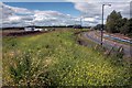
Construction of New Access Road into North Middlesbrough
Work has just started on the new access into Riverside Park and North Middlesbrough from the A66 at Newport island. The route has been set out and the site cleared and topsoil stripped. The contractor's cabins have been set up and the compound is currently being fenced off. Between the camera and the compound the new road will interchange with the Riverside Park Road along which a new water main is being laid.
Image: © Mick Garratt
Taken: 10 Jul 2008
0.12 miles
7
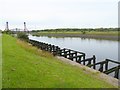
Old coal staithes on the Tees
Downstream from the Tees Newport Bridge Image
Image: © Oliver Dixon
Taken: 6 Jul 2016
0.13 miles
9
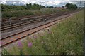
Site of Proposed New Road Bridge
Work has just started on the new access into Riverside Park and North Middlesbrough from the A66 at Newport island. A new bridge is being prefabricated off site and will be lowered into place to minimise disruption. I estimate the bridge will cross diagonally towards the camera from the grey trackside boxes on the far side of the railway. On the right in the distance is the A1032 approach to Newport Bridge.
Image: © Mick Garratt
Taken: 10 Jul 2008
0.14 miles
10
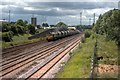
Site of Proposed New Road Bridge
Work has just started on the new access into Riverside Park and North Middlesbrough from the A66 at Newport island. A new bridge is being prefabricated off site and will be lowered into place to minimise disruption. I estimate the bridge will cross diagonally about where the last truck is on this train of empties wagons back to Cleveland Potash.
Image: © Mick Garratt
Taken: 10 Jul 2008
0.15 miles