
IMAGES TAKEN NEAR TO
The Garth, STOCKTON-ON-TEES, TS21 3BG
Introduction
This page details the photographs taken nearby to The Garth, TS21 3BG by members of the Geograph project.
The Geograph project started in 2005 with the aim of publishing, organising and preserving representative images for every square kilometre of Great Britain, Ireland and the Isle of Man.

There are currently over 7.5m images from over14,400 individuals and you can help contribute to the project by visiting https://www.geograph.org.uk
Image Map
Images are licensed for reuse under creativecommons.org/licenses/by-sa/2.0
Notes
- Clicking on the map will re-center to the selected point.
- The higher the marker number, the further away the image location is from the centre of the postcode.
Image Listing (116 Images Found)
Images are licensed for reuse under creativecommons.org/licenses/by-sa/2.0
Image
Details
Distance
1
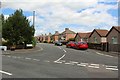
Chestnut Road, Sedgefield
A residential street of semi-detached houses to the north of Sedgefield town centre.
Image: © Graham Robson
Taken: 6 Jul 2019
0.04 miles
2
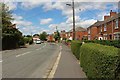
The Lane, Sedgefield
A residential street to the north of Sedgefield town centre.
Image: © Graham Robson
Taken: 6 Jul 2019
0.05 miles
3
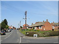
The Lane, Sedgefield
The Lane is a residential road in Sedgefield, in County Durham.
Image: © Malc McDonald
Taken: 20 Apr 2019
0.10 miles
4
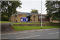
Sedgefield Methodist Church, North End, Sedgefield
Taken to replicate the first image submitted for this square (2004). https://www.geograph.org.uk/photo/52057
Image: © Ian S
Taken: 12 Sep 2020
0.10 miles
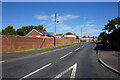
6
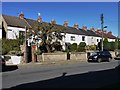
East Parade, East End, Sedgefield
The terrace at East Parade was built in the C19th during a period of expansion of the town. the narrow alley running west from this road can be seen at the left end of the terrace Image
Image: © Andrew Curtis
Taken: 7 Oct 2011
0.11 miles
7
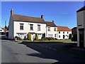
East Well House, Sedgefield
This was built as an C18th farmhouse which were built outside the town after the enclosure of common land in 1636. The original Sedgefield workhouse used to stand next to the farm, but was demolished in the mid C19th.
http://www.sedgefield.net/hertrail/eastwell.html
Image: © Andrew Curtis
Taken: 7 Oct 2011
0.12 miles
8
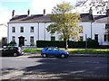
The White House, North End, Sedgefield
The smart white-painted houses here were built as a single large farmhouse around 1790 http://www.sedgefield.net/hertrail/whitehouse.html
National Heritage List for England Entry Number: 1159967 https://www.historicengland.org.uk/listing/the-list/list-entry/1159967
Image: © Andrew Curtis
Taken: 7 Oct 2011
0.12 miles
9
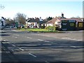
West Park Motors, Sedgefield
Garage at North End, Sedgefield.
Image: © Oliver Dixon
Taken: 4 Apr 2007
0.12 miles
10
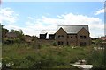
Unfinished house, Butterwick Road, Sedgefield
A large house off Butterwick Road. Building appears to have come to a halt sometime ago with the external structure largely complete but still with substantial work to do to complete the home.
Image: © Graham Robson
Taken: 6 Jul 2019
0.12 miles