
IMAGES TAKEN NEAR TO
Stapleton Street, STOCKTON-ON-TEES, TS20 1NP
Introduction
This page details the photographs taken nearby to Stapleton Street, TS20 1NP by members of the Geograph project.
The Geograph project started in 2005 with the aim of publishing, organising and preserving representative images for every square kilometre of Great Britain, Ireland and the Isle of Man.

There are currently over 7.5m images from over14,400 individuals and you can help contribute to the project by visiting https://www.geograph.org.uk
Image Map
Images are licensed for reuse under creativecommons.org/licenses/by-sa/2.0
Notes
- Clicking on the map will re-center to the selected point.
- The higher the marker number, the further away the image location is from the centre of the postcode.
Image Listing (18 Images Found)
Images are licensed for reuse under creativecommons.org/licenses/by-sa/2.0
Image
Details
Distance

2
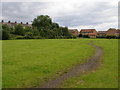
Tinker's Yard
Has been tidied up and is kept well mown, thus providing a play area to replace the school grounds.
Image: © Carol Rose
Taken: 1 Jul 2007
0.07 miles
3
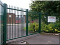
Daunting railings at Crooksbarn School
The school grounds used to be a community resource where children could play off the streets. They are now under lock and key.
Image: © Carol Rose
Taken: 1 Jul 2007
0.08 miles
5
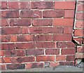
Norton, 57 Station Road
The benchmark is cut into the gable end of 57 Station Road.
Image: © Mel Towler
Taken: 19 Feb 2022
0.13 miles
6
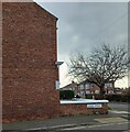
Norton, 57 Station Road
There is a benchmark cut into the gable end of 57 Station Road. The gable end faces onto Crook Street.
Image: © Mel Towler
Taken: 19 Feb 2022
0.13 miles
7
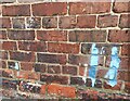
Norton, signal box
The benchmark is cut into the 6th and 7th course of the west facing wall of the signal box.
Image: © Mel Towler
Taken: 19 Feb 2022
0.13 miles
8
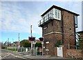
Norton, signal box
There is a benchmark cut into the 6th and 7th course of bricks of the west facing wall of the signal box.
Image: © Mel Towler
Taken: 19 Feb 2022
0.13 miles
9
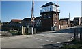
Norton Signal Box
Viewed from outside the square as the easting bisects the level crossing.
Image: © Mick Garratt
Taken: 6 Feb 2007
0.14 miles
10
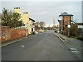
Level crossing at east end of former Norton railway station, County Durham
Image: © Nigel Thompson
Taken: 1 Jan 2015
0.15 miles