IMAGES TAKEN NEAR TO
Spencer Drive, STOCKTON-ON-TEES, TS20 1FG

Introduction

This page details the photographs taken nearby to Spencer Drive, TS20 1FG by members of the Geograph project.

The Geograph project started in 2005 with the aim of publishing, organising and preserving representative images for every square kilometre of Great Britain, Ireland and the Isle of Man.

There are currently over 7.5m images from over14,400 individuals and you can help contribute to the project by visiting https://www.geograph.org.uk

Image Map (Loading...)

MarkerMarker

Images are licensed for reuse under creativecommons.org/licenses/by-sa/2.0
Notes
  • Clicking on the map will re-center to the selected point.
  • The higher the marker number, the further away the image location is from the centre of the postcode.

Image Listing (14 Images Found)

Images are licensed for reuse under creativecommons.org/licenses/by-sa/2.0
Image
Details
Distance
1
Norton, Grantham Road
According to the OS benchmark database there was a benchmark cut into a stone wall at this location. The wall has been replaced and the benchmark has been destroyed.
Image: © Mel Towler Taken: 19 Feb 2022
0.07 miles
2
Norton, Junction Road
The benchmark is cut into a gatepost on the north side of the road.
Image: © Mel Towler Taken: 19 Feb 2022
0.10 miles
3
Norton, Junction Road
There is a benchmark cut into the brick gatepost to the left of the driveway of the property, on the north side of the road.
Image: © Mel Towler Taken: 19 Feb 2022
0.10 miles
4
Norton, 57 Station Road
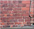
The benchmark is cut into the gable end of 57 Station Road.
Image: © Mel Towler Taken: 19 Feb 2022
0.16 miles
5
Norton, 57 Station Road
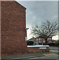
There is a benchmark cut into the gable end of 57 Station Road. The gable end faces onto Crook Street.
Image: © Mel Towler Taken: 19 Feb 2022
0.16 miles
6
Church of St. Mary the Virgin
Parish Church of Norton near Stockton on Tees
Image: © George Ford Taken: 6 Aug 2005
0.20 miles
7
Pre-season football training
Some of the sports facilities at Norton. The indoor cricket hall is at the left foreground and the Northern Premier League football pitch in the left distance.
Image: © Ian Barton Taken: 16 Aug 2008
0.22 miles
8
The newly designated Dove Lane
Originally a service road for the rear gardens of Station Road. Now a 'proper' road because permission is being given to build houses in many of Station Road's rear gardens.
Image: © Carol Rose Taken: 1 Jul 2007
0.22 miles
9
St Mary's church tower
Image: © Carol Rose Taken: 1 Jul 2007
0.23 miles
10
Norton, St Mary's church
The benchmark is cut into an east facing buttress.
Image: © Mel Towler Taken: 19 Feb 2022
0.23 miles