IMAGES TAKEN NEAR TO
Ross Road, STOCKTON-ON-TEES, TS18 2NH
Introduction
This page details the photographs taken nearby to Ross Road, TS18 2NH by members of the Geograph project.
The Geograph project started in 2005 with the aim of publishing, organising and preserving representative images for every square kilometre of Great Britain, Ireland and the Isle of Man.

There are currently over 7.5m images from over14,400 individuals and you can help contribute to the project by visiting https://www.geograph.org.uk
Image Map (Loading...)


Getting Data...Please wait
Leaflet Map data © OpenStreetMap
Images are licensed for reuse under creativecommons.org/licenses/by-sa/2.0
Notes
- Clicking on the map will re-center to the selected point.
- The higher the marker number, the further away the image location is from the centre of the postcode.
Image Listing (13 Images Found)
Images are licensed for reuse under creativecommons.org/licenses/by-sa/2.0
Image
Details
Distance
3
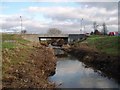
Lustrum Beck
This photograph shows a view of Lustrum Beck as it makes its way in a south-easterly direction from Mount Pleasant towards Portrack Industrial Estate. This picture was taken looking downstream in an east-south-easterly direction.
Image: © Philip Barker
Taken: 29 Jan 2010
0.12 miles
4
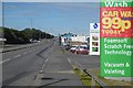
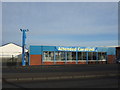
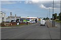
Portrack Lane
Tin shed land, Stockton. Portrack Lane is the dual carriageway A1046.
Image: © Richard Webb
Taken: 10 Aug 2016
0.16 miles
5
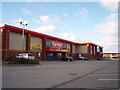
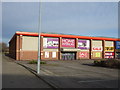
Harveys Factory Outlet
This photograph shows a view of Harveys - a local furniture store near the A1046 road on Portrack Industrial Estate. The Mandale Furniture store can also be seen on the right-hand side of the picture. The photograph was taken from the car park outside a Staples Super-store looking in a north-north-westerly direction.
Image: © Philip Barker
Taken: 29 Jan 2010
0.16 miles
6
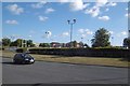
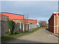
Holme House Road
Retail sheds on the site of Portrack Grange Farm.
Image: © Richard Webb
Taken: 10 Aug 2016
0.16 miles
9
Traffic lights on the A1046
Looking along Portrack Lane at the junction with Malleable Way.
Image: © DS Pugh
Taken: 1 Aug 2016
0.17 miles
10
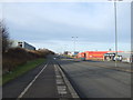
Portrack Lane
The lane is a dual carriageway. On the other side, beyond the bus stop there is the site of a steel works.
Image: © Richard Webb
Taken: 10 Aug 2016
0.18 miles