
IMAGES TAKEN NEAR TO
Black Diamond Way, STOCKTON-ON-TEES, TS16 0SE
Introduction
This page details the photographs taken nearby to Black Diamond Way, TS16 0SE by members of the Geograph project.
The Geograph project started in 2005 with the aim of publishing, organising and preserving representative images for every square kilometre of Great Britain, Ireland and the Isle of Man.

There are currently over 7.5m images from over14,400 individuals and you can help contribute to the project by visiting https://www.geograph.org.uk
Image Map
Images are licensed for reuse under creativecommons.org/licenses/by-sa/2.0
Notes
- Clicking on the map will re-center to the selected point.
- The higher the marker number, the further away the image location is from the centre of the postcode.
Image Listing (8 Images Found)
Images are licensed for reuse under creativecommons.org/licenses/by-sa/2.0
Image
Details
Distance
2
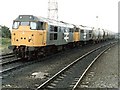
Eaglescliffe Junction
31184 and 31229 just clearing the junction with a tanker train
Image: © Dave Hitchborne
Taken: 17 Jun 1985
0.15 miles
4
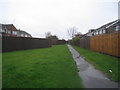
Footpath between the houses
Links Burnmoor Drive with Meadow End. Photograph taken in pouring rain.
Image: © Jonathan Thacker
Taken: 26 Nov 2012
0.19 miles
5
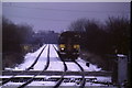
In the snow near Eaglescliffe
A train approaching Allen's West station in wintry weather in 1993.
Image: © Malc McDonald
Taken: 22 Nov 1993
0.23 miles
8
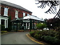
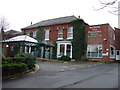
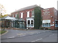
Parkmore Hotel, Eaglescliffe
A pleasant hotel, although if you get a room near the back, you are rather near the railway line (and freight trains use it occasionally through the night).
See http://www.parkmorehotel.co.uk/
Image: © Rich Tea
Taken: 16 Jun 2010
0.24 miles