
IMAGES TAKEN NEAR TO
High Leven, YARM, TS15 9JW
Introduction
This page details the photographs taken nearby to TS15 9JW by members of the Geograph project.
The Geograph project started in 2005 with the aim of publishing, organising and preserving representative images for every square kilometre of Great Britain, Ireland and the Isle of Man.

There are currently over 7.5m images from over14,400 individuals and you can help contribute to the project by visiting https://www.geograph.org.uk
Image Map
Images are licensed for reuse under creativecommons.org/licenses/by-sa/2.0
Notes
- Clicking on the map will re-center to the selected point.
- The higher the marker number, the further away the image location is from the centre of the postcode.
Image Listing (11 Images Found)
Images are licensed for reuse under creativecommons.org/licenses/by-sa/2.0
Image
Details
Distance
3
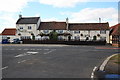
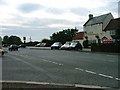
The Fox Covert Inn
This photograph shows a view of The Fox Covert Inn which is located on the A1044 at High Leven opposite the road junction formed by the intersection of the A1044 and the minor road that runs between High Leven (ahead) and Hilton (behind the photographer). The picture was taken looking in a north-north-westerly direction towards Ingleby Barwick.
Image: © Philip Barker
Taken: 18 Sep 2010
0.13 miles
4
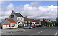
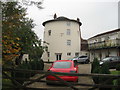
The Fox Covert : High Leven
Formerly named The Half Moon Inn, the small community of High Leven, on a crossroads, had a blacksmiths next to the pub and a windmill to the north (now a private house).
Image: © Hugh Mortimer
Taken: 3 Sep 2006
0.13 miles
6
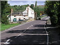
Leven Bridge
Leven Bridge and Leven Bank on the A1044, with the ruin of the Cross Keys public house, and row of listed buildings, that have remained empty.
Image: © Hugh Mortimer
Taken: 2 Sep 2006
0.19 miles
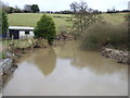
9
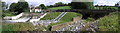
Leven Bridge Weir
A Mill stream ran to the north, to Leven Bridge Mill. The derelict building visible is part of the old Cross Keys public house, a popular watering hole on a bend in the River Leven, closed sometime in the late 1960's.
Image: © Hugh Mortimer
Taken: 3 Sep 2006
0.21 miles
10
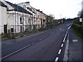
Leven Bridge
A notorious road crossing of the River Leven with steep banks both sides. The building is I believe listed and has stood derelict for years.
Image: © Mick Garratt
Taken: 5 Nov 2005
0.23 miles