IMAGES TAKEN NEAR TO
Greenlands, YARM, TS15 0JQ
Introduction
This page details the photographs taken nearby to Greenlands, TS15 0JQ by members of the Geograph project.
The Geograph project started in 2005 with the aim of publishing, organising and preserving representative images for every square kilometre of Great Britain, Ireland and the Isle of Man.

There are currently over 7.5m images from over14,400 individuals and you can help contribute to the project by visiting https://www.geograph.org.uk
Image Map
Images are licensed for reuse under creativecommons.org/licenses/by-sa/2.0
Notes
- Clicking on the map will re-center to the selected point.
- The higher the marker number, the further away the image location is from the centre of the postcode.
Image Listing (5 Images Found)
Images are licensed for reuse under creativecommons.org/licenses/by-sa/2.0
Image
Details
Distance
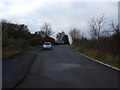
4
Blue Barn Lane
This photograph shows a view of a section of Blue Barn Lane which runs between Rudby (behind the photographer) and Crathorne (ahead). The picture was taken looking in an westerly direction towards the entrance to Blue Barn Farm.
Image: © Philip Barker
Taken: 2 Oct 2010
0.11 miles
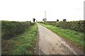
5
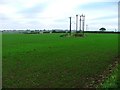
Array of Electricity Poles, Blue Barn Lane
This array of electricity poles is in a field north of Blue Barn Lane. View north east.
Image: © Mick Garratt
Taken: 15 Oct 2005
0.23 miles