IMAGES TAKEN NEAR TO
Goldie Hill, YARM, TS15 0DE

Introduction

This page details the photographs taken nearby to Goldie Hill, TS15 0DE by members of the Geograph project.

The Geograph project started in 2005 with the aim of publishing, organising and preserving representative images for every square kilometre of Great Britain, Ireland and the Isle of Man.

There are currently over 7.5m images from over14,400 individuals and you can help contribute to the project by visiting https://www.geograph.org.uk

Image Map


Images are licensed for reuse under creativecommons.org/licenses/by-sa/2.0
Notes
  • Clicking on the map will re-center to the selected point.
  • The higher the marker number, the further away the image location is from the centre of the postcode.

Image Listing (30 Images Found)

Images are licensed for reuse under creativecommons.org/licenses/by-sa/2.0
  • ...
Image
Details
Distance
1
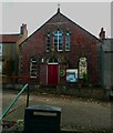
Former Primitive Methodist Chapel, Hutton Rudby
This is now a church hall. I was attracted by the window with small panes of coloured glass, white, grey and yellow arranged randomly.
Image: © Humphrey Bolton Taken: 26 Oct 2022
0.02 miles
2
Library in a telephone box, Hutton Rudby
Image: © Humphrey Bolton Taken: 26 Oct 2022
0.03 miles
3
The Kings Head
One of at least three pubs in Hutton Rudby.
Image: © Gordon Hatton Taken: 20 Dec 2020
0.03 miles
4
R.V. Honeyman
Butcher's shop, Hutton Rudby.
Image: © Richard Webb Taken: 10 Aug 2016
0.04 miles
5
West End, Hutton Rudby
View towards the King's Head and post office. Near here is the Methodist chapel which provides a high quality cafe on most mornings and Wednesday afternoon. By good fortune today was Wednesday.
Image: © Richard Webb Taken: 10 Aug 2016
0.04 miles
6
Hutton Rudby Post Office March 1959
Taken by my late father, this scene hasn't changed that much, apart from massively more traffic
Image: © Tony Whelan (Deceased) Taken: Unknown
0.04 miles
7
Road junction in Hutton Rudby
This photograph shows a view of a road junction formed by the intersection of Westholme (on the right) with West End (on the left) - from where the photograph was taken. The picture was taken looking in a north-easterly direction towards Hutton Bridge.
Image: © Philip Barker Taken: 30 Sep 2010
0.06 miles
8
North End, Hutton Rudby
Here there is an old (pre-Worboys) 'No through road' sign.
Image: © Humphrey Bolton Taken: 26 Oct 2022
0.06 miles
9
War memorial, Hutton Rudby
On a small island site at the junction of North End and West End.
Image: © Gordon Hatton Taken: 20 Dec 2020
0.07 miles
10
Northside, Hutton Rudby
An appropriate name for this row of houses along the north side of the green.
Image: © Gordon Hatton Taken: 20 Dec 2020
0.07 miles
  • ...