IMAGES TAKEN NEAR TO
Gresham Road, MIDDLESBROUGH, TS1 4LL
Introduction
This page details the photographs taken nearby to Gresham Road, TS1 4LL by members of the Geograph project.
The Geograph project started in 2005 with the aim of publishing, organising and preserving representative images for every square kilometre of Great Britain, Ireland and the Isle of Man.

There are currently over 7.5m images from over14,400 individuals and you can help contribute to the project by visiting https://www.geograph.org.uk
Image Map (Loading...)


Getting Data...Please wait
Leaflet Map data © OpenStreetMap
Images are licensed for reuse under creativecommons.org/licenses/by-sa/2.0
Notes
- Clicking on the map will re-center to the selected point.
- The higher the marker number, the further away the image location is from the centre of the postcode.
Image Listing (17 Images Found)
Images are licensed for reuse under creativecommons.org/licenses/by-sa/2.0
Image
Details
Distance
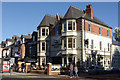
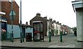
1
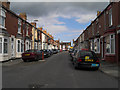
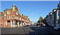
Athol Street
Athol Street looking towards Gresham Road
Image: © Mike Guess
Taken: 26 Sep 2006
0.06 miles
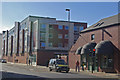
4
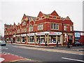
Maplin shop on Linthorpe Road
This photograph shows a view of the Maplin electronics shop in Middlesbrough. The shop itself is located within the Forbes Building near the junction of Linthorpe Road and Gresham Road. This picture was taken from the opposite side of the road looking in a south-westerly direction.
Image: © Philip Barker
Taken: 21 Jan 2010
0.12 miles
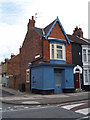
6
The Swatters Carr, Middlesbrough
This Wetherspoons pub on Linthorpe Road revives the name of the Swatters Carr Hotel, recorded in 1891, which itself was named after a farmhouse that once stood on the site. The establishment later became the Empire and more recently had a series of names before Wetherspoons took over.
Image: © Stephen McKay
Taken: 13 Oct 2012
0.18 miles
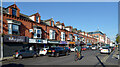
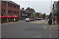
7
Linthorpe Road, Middlesbrough
Looking along Linthorpe Road from its junction with Southfield Road. Linthorpe Hall is modern student accommodation.
Image: © Stephen McKay
Taken: 13 Oct 2012
0.19 miles
9
Apartment block at the junction of Ayresome Street and Linthorpe Road (B1272), Middlesbrough
Image: © habiloid
Taken: 29 Oct 2021
0.21 miles
10
Warren Street From Union Street
The council has blocked many of these streets off to prevent rat runs occurring.
Image: © Mick Garratt
Taken: 17 Oct 2006
0.22 miles