
IMAGES TAKEN NEAR TO
Sandwood Park, GUISBOROUGH, TS14 8EH
Introduction
This page details the photographs taken nearby to Sandwood Park, TS14 8EH by members of the Geograph project.
The Geograph project started in 2005 with the aim of publishing, organising and preserving representative images for every square kilometre of Great Britain, Ireland and the Isle of Man.

There are currently over 7.5m images from over14,400 individuals and you can help contribute to the project by visiting https://www.geograph.org.uk
Image Map
Images are licensed for reuse under creativecommons.org/licenses/by-sa/2.0
Notes
- Clicking on the map will re-center to the selected point.
- The higher the marker number, the further away the image location is from the centre of the postcode.
Image Listing (11 Images Found)
Images are licensed for reuse under creativecommons.org/licenses/by-sa/2.0
Image
Details
Distance
1

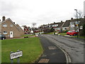
Early morning sun
Looking across towards Hutton Gate.
Image: © Jay Pea
Taken: 7 Sep 2025
0.09 miles
3
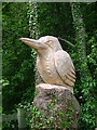
Kingfisher
One of a series of wood carvings along the route of the disused railway from Guisborough Forest and Walkway Visitor Centre at Pinchinthorp.
Image: © Mick Garratt
Taken: 22 May 2005
0.18 miles
4
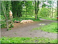
Guisborough Walkway
Country park created from a section of the old Middlesbrough to Guisborough railway.
Image: © Mick Garratt
Taken: 24 May 2005
0.18 miles
5

Sunset towards Roseberry
Photo taken looking west across Home Farm Fields.
Image: © Geoff Bailey
Taken: 17 Nov 2005
0.18 miles
6

Farm track and path
A well used track and path.
Image: © Jay Pea
Taken: 7 Sep 2025
0.22 miles
7
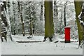
Post Box on The Avenue, Guisborough
Corner of Farndale Drive
Image: © doug scarr
Taken: 15 Jan 2013
0.22 miles
8
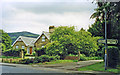
Hutton Lane, near site of Hutton Gate station
View SE to the edge of the Cleveland Hills (Cod Hill, 1,024 ft.). The station had been in the trees on the right and was on the ex-NER line from Middlesbrough to Guisborough, Brotton, Loftus, Whitby and Scarborough. The station had been closed 2/3/53, but a passenger service (Middlesbrough - Guisborough - Loftus only) continued until 2/5/60 and the line remained open for freight until 2/3/64.
Image: © Ben Brooksbank
Taken: 24 Jun 1997
0.23 miles
9
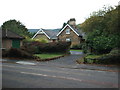
Hutton Gate railway station (site), Yorkshire
Opened in 1867 by the North Eastern Railway on the line from Middlesbrough to Guisborough, this was a private station for the chairman of the railway company until 1904 when it was opened to the public. It closed in 1964.
View south across the former platforms to the station building, now a private residence.
Image: © Nigel Thompson
Taken: 10 Oct 2009
0.23 miles
10

Arable fields
A recently sown arable crop just started to emerge with new crops.
Image: © Jay Pea
Taken: 6 Sep 2025
0.24 miles