IMAGES TAKEN NEAR TO
Dorset Road, GUISBOROUGH, TS14 7DN
Introduction
This page details the photographs taken nearby to Dorset Road, TS14 7DN by members of the Geograph project.
The Geograph project started in 2005 with the aim of publishing, organising and preserving representative images for every square kilometre of Great Britain, Ireland and the Isle of Man.

There are currently over 7.5m images from over14,400 individuals and you can help contribute to the project by visiting https://www.geograph.org.uk
Image Map
Images are licensed for reuse under creativecommons.org/licenses/by-sa/2.0
Notes
- Clicking on the map will re-center to the selected point.
- The higher the marker number, the further away the image location is from the centre of the postcode.
Image Listing (10 Images Found)
Images are licensed for reuse under creativecommons.org/licenses/by-sa/2.0
Image
Details
Distance
1
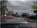
Sainsbury's supermarket
Morrisons have a similar size store in the town and there's a smaller Cooperative store and filling station on the bypass one square north.
Image: © Colin Grice
Taken: 20 Aug 2010
0.15 miles
2

Course of the NER’s Guisborough branch
Course of the NER’s Guisborough branch, east of the junction where the line branched to the terminus station in Guisborough, this section of the line went forward to allow both north and south access to the Saltburn - Whitby line between Skelton and Brotton.
Image: © David Robinson
Taken: 19 May 2025
0.16 miles
3

On the Branch Line
The disused rail line now a footpath through housing estates
Image: © Michael Graham
Taken: 8 Apr 2010
0.17 miles
4
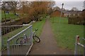
Footpath to Back of Housing
A footpath running alongside Chapel Beck on the left to the back of a small housing estate comprising small bungalows. The child's bike was chained to railings.
Image: © Mick Garratt
Taken: 22 Jan 2008
0.19 miles
5
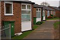
Front of Housing
An estate of small bungalows.
Image: © Mick Garratt
Taken: 22 Jan 2008
0.19 miles
6
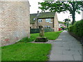
Ruther Cross
Marking the one mile point on the old Guisborough to Kildale pannier route. Now enclosed by a modern housing estate.
Image: © Mick Garratt
Taken: 24 May 2005
0.20 miles