IMAGES TAKEN NEAR TO
Belmangate, GUISBOROUGH, TS14 7AB
Introduction
This page details the photographs taken nearby to Belmangate, TS14 7AB by members of the Geograph project.
The Geograph project started in 2005 with the aim of publishing, organising and preserving representative images for every square kilometre of Great Britain, Ireland and the Isle of Man.

There are currently over 7.5m images from over14,400 individuals and you can help contribute to the project by visiting https://www.geograph.org.uk
Image Map
Images are licensed for reuse under creativecommons.org/licenses/by-sa/2.0
Notes
- Clicking on the map will re-center to the selected point.
- The higher the marker number, the further away the image location is from the centre of the postcode.
Image Listing (120 Images Found)
Images are licensed for reuse under creativecommons.org/licenses/by-sa/2.0
Image
Details
Distance
1
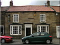
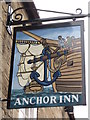
The Anchor Inn
One of two Sam Smith pubs in Guisborough.
Image: © Ian S
Taken: 23 Jun 2010
0.01 miles
2
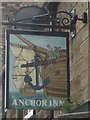
The Anchor Inn
A Sam Smith's pub in Guisborough.
Image: © Ian S
Taken: 23 Jun 2010
0.01 miles
3
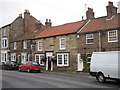
The Anchor Inn
One of two Sam Smith's public houses in Guisborough.
Image: © Ian S
Taken: 25 Aug 2012
0.02 miles
4
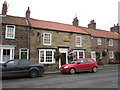
The Anchor Inn
One of two Sam Smith's public houses in Guisborough.
Image: © Ian S
Taken: 25 Aug 2012
0.02 miles
5
The beer garden at the Anchor Inn
One of two Sam Smith's public houses in Guisborough.
Image: © Ian S
Taken: 25 Aug 2012
0.03 miles
6
The Anchor Inn
One of two Sam Smith's public houses in Guisborough.
Image: © Ian S
Taken: 25 Aug 2012
0.03 miles
9
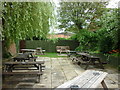
The beer garden at the Anchor Inn
One of two Sam Smith's public houses in Guisborough.
Image: © Ian S
Taken: 25 Aug 2012
0.04 miles
10
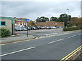
Guisborough railway station (site), Yorkshire
Opened in 1854 by the Middlesbrough & Guisborough Railway, later part of the North Eastern Railway, this terminus station closed in 1964.
View north east towards the buffers, along the line of the platforms. The main building was on the right of the image where the car-park now is. Rectory Lane in the foreground was built after closure of the railway, cutting straight across the site.
Image: © Nigel Thompson
Taken: 10 Oct 2009
0.08 miles