
IMAGES TAKEN NEAR TO
GUISBOROUGH, TS14 6RP
Introduction
This page details the photographs taken nearby to TS14 6RP by members of the Geograph project.
The Geograph project started in 2005 with the aim of publishing, organising and preserving representative images for every square kilometre of Great Britain, Ireland and the Isle of Man.

There are currently over 7.5m images from over14,400 individuals and you can help contribute to the project by visiting https://www.geograph.org.uk
Image Map
Images are licensed for reuse under creativecommons.org/licenses/by-sa/2.0
Notes
- Clicking on the map will re-center to the selected point.
- The higher the marker number, the further away the image location is from the centre of the postcode.
Image Listing (4 Images Found)
Images are licensed for reuse under creativecommons.org/licenses/by-sa/2.0
Image
Details
Distance
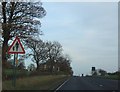
2

Snow-laden field near Mill Farm
This picture shows a snow-laden field near Mill Farm. It was taken from the public footpath that runs from Flatts Lane to the A171 road. Mill Farm can be seen in the distance and on the horizon it is just possible to see Highcliff Nab. Hutton Lowcross Woods and Guisborough Woods are also visible just below the horizon.
Image: © Philip Barker
Taken: 20 Dec 2009
0.22 miles
3
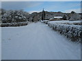
Access track to Mill Farm
This picture shows the snow-bound access track to Mill Farm. The picture was taken from a location near the A171 dual-carriageway looking in a northerly direction towards Upsall Moor.
Image: © Philip Barker
Taken: 20 Dec 2009
0.24 miles
4

Brick Structure, Near Quarry Plantation
I am not sure what this structure is. It is tempting to suggest it is some sort of shaft for the nearby ironstone mines, an air vent perhaps, but I don't think any of the workings extended below here. There are records of exploratory shafts being sunk but no ore was found because of a fault which lifted the seam by over 500 feet. There are disused quarries marked on the map directly and higher up the slope so maybe it's something to do with them. Some of the bricks are stamped "NORMANBY" which was situated at NZ545166.
Image: © Mick Garratt
Taken: 2 Sep 2007
0.25 miles