
IMAGES TAKEN NEAR TO
Minskip Close, GUISBOROUGH, TS14 6GQ
Introduction
This page details the photographs taken nearby to Minskip Close, TS14 6GQ by members of the Geograph project.
The Geograph project started in 2005 with the aim of publishing, organising and preserving representative images for every square kilometre of Great Britain, Ireland and the Isle of Man.

There are currently over 7.5m images from over14,400 individuals and you can help contribute to the project by visiting https://www.geograph.org.uk
Image Map
Images are licensed for reuse under creativecommons.org/licenses/by-sa/2.0
Notes
- Clicking on the map will re-center to the selected point.
- The higher the marker number, the further away the image location is from the centre of the postcode.
Image Listing (7 Images Found)
Images are licensed for reuse under creativecommons.org/licenses/by-sa/2.0
Image
Details
Distance
2
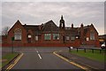
Former Northgate Primary School
Local residents were dismayed when this building, built in 1879, was recently sold for demolition and development into sheltered housing. The Guisborough Market Town Partnership had offered to buy the building from the Redcar and Cleveland Council and proposed to convert it into a Community Centre. But the site was sold to a private company, Golden Living. January 2007: the roof slates have been removed, presumably for salvage, and the building awaits the demolition gang.
Image: © Mick Garratt
Taken: 22 Jan 2008
0.17 miles
3
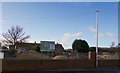
New Housing at Wilton Lane
The site used to be a school, then was a bare plot for several years.
Image: © Colin Grice
Taken: 31 Jan 2018
0.17 miles
4
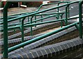
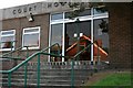
Wheelchair Access to Guisborough Magistrates Court
Image: © Mick Garratt
Taken: 4 Oct 2007
0.18 miles
6
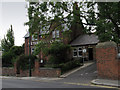
Wilton House Vet Clinic
Wilton Lane, Guisborough.
Image: © Colin Grice
Taken: 2 Aug 2010
0.20 miles
7
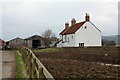
Howlbeck Farm
This photograph shows a view of Howlbeck Farm. The picture was taken from the public footpath that passes through the farm. The viewing direction was east-north-easterly looking towards the B1269 road (Redcar Road).
Image: © Philip Barker
Taken: 2 Apr 2010
0.24 miles