
IMAGES TAKEN NEAR TO
Brompton Avenue, GUISBOROUGH, TS14 6GH
Introduction
This page details the photographs taken nearby to Brompton Avenue, TS14 6GH by members of the Geograph project.
The Geograph project started in 2005 with the aim of publishing, organising and preserving representative images for every square kilometre of Great Britain, Ireland and the Isle of Man.

There are currently over 7.5m images from over14,400 individuals and you can help contribute to the project by visiting https://www.geograph.org.uk
Image Map
Images are licensed for reuse under creativecommons.org/licenses/by-sa/2.0
Notes
- Clicking on the map will re-center to the selected point.
- The higher the marker number, the further away the image location is from the centre of the postcode.
Image Listing (10 Images Found)
Images are licensed for reuse under creativecommons.org/licenses/by-sa/2.0
Image
Details
Distance
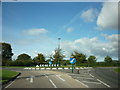
1
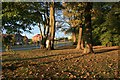
Church Lane
Evening autumnal sunshine from the entrance to Laurence Jackson School.
Image: © Mick Garratt
Taken: 4 Oct 2007
0.14 miles
2
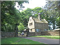
Lodge at the entrance to Gisborough Hall
Image: © John Slater
Taken: 24 Jun 2018
0.17 miles
3
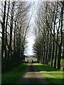
Former Rear Entrance to Gisborough Hall
The tradesman's entrance!!!
Image: © Mick Garratt
Taken: 25 Apr 2006
0.18 miles
4
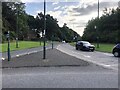
Junction of Church Lane and the A171 at Guisborough
Image: © Eirian Evans
Taken: 15 Sep 2021
0.18 miles
6
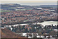
Guisborough, ancient capital of Cleveland
373 years ago today (16 Jan 2016) Guisborough would have looked a totally different place. Now housing estates dominate the scene but in 1643 it would be a gentle rural scene with the “town” just a strip of houses on the right of this photo. The railway and the ironstone and the alum industries had still to impact the town. In may have just snowed like today but in a field on the edge of the town 700 newly recruited Royalist troops were being mustered by Colonel Guilford Slingsby for a march to Whitby. Where they actually were is not known. Some say it was in a field which at one time was called “War Field” but which is now a small housing estate to the west of the town’s Lawrence Jackson School (top right in the photo). Another suggestion is a field off Butts Lane.
Whitby was the home of Sir Hugh Chomeley, a Parliamentarian, who was absent having joined Lord Fairfax in his campaign against the King’s headquarters in York. The news had reached Chomeley however who had set off across the moors with 500 men plus cavalry and dragoons and two field artillery. It is not known which route they took. But at a guess Kirkbymoorside, Blakey Ridge and Castleton, approaching Guisborough from Birk Brow. So the scene is set, on the 16 January 1643, for the Battle of Guisborough, a lesser known battle of the English Civil War.
It turned out to be an outright victory for the Parliamentarians who took many prisoners. The Royalist commander lost both his legs. The Parliamentarians then moved to Yarm to protect the river bridge from being used by a supply train organised by the Duke of Newcastle for the King at York. 16 days later the Battle of Yarm took place but this time it was the Royalists who won.
Within a month Sir Hugh Chomeley had changed sides and became a Royalist which was not a good move as it upset quite a few people. He should have stuck to the winning side. After the war he spent the rest of his life in exile.
https://fhithich.wordpress.com/2016/01/16/guisborough-ancient-capital-of-cleveland/
Image: © Mick Garratt
Taken: 16 Jan 2016
0.18 miles
7
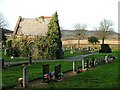
Small Chapel, Guisborough Cemetery
View north west.
Image: © Mick Garratt
Taken: 17 Dec 2005
0.21 miles
9

New Cemetery
The old cemetery, on the far side of the hedge, is in the adjacent square.
Image: © Mick Garratt
Taken: 4 Oct 2007
0.22 miles
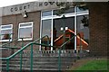
10
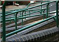
Wheelchair Access to Guisborough Magistrates Court
Image: © Mick Garratt
Taken: 4 Oct 2007
0.22 miles