
IMAGES TAKEN NEAR TO
Hillcrest Drive, SALTBURN-BY-THE-SEA, TS13 4YA
Introduction
This page details the photographs taken nearby to Hillcrest Drive, TS13 4YA by members of the Geograph project.
The Geograph project started in 2005 with the aim of publishing, organising and preserving representative images for every square kilometre of Great Britain, Ireland and the Isle of Man.

There are currently over 7.5m images from over14,400 individuals and you can help contribute to the project by visiting https://www.geograph.org.uk
Image Map
Images are licensed for reuse under creativecommons.org/licenses/by-sa/2.0
Notes
- Clicking on the map will re-center to the selected point.
- The higher the marker number, the further away the image location is from the centre of the postcode.
Image Listing (7 Images Found)
Images are licensed for reuse under creativecommons.org/licenses/by-sa/2.0
Image
Details
Distance
1
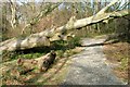
Path in Rosecroft Wood
Along the wooded Waytail Beck.
Image: © Mick Garratt
Taken: 5 Mar 2008
0.05 miles
3
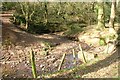
Waytail Beck
Flowing through Rosecroft Wood.
Image: © Mick Garratt
Taken: 5 Mar 2008
0.09 miles
4
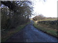
Rosecroft Lane
Heading north towards Loftus.
Image: © JThomas
Taken: 8 Feb 2014
0.10 miles
5
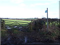
Footpath off Rosecroft Lane
Towards Loftus Wood.
Image: © JThomas
Taken: 8 Feb 2014
0.13 miles
6
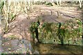
Old Bridge Abutment, Loftus Wood
This seems to be the foundations of an old bridge of some substance but I can find no record of any industrial activity along this beck.
Image: © Mick Garratt
Taken: 5 Mar 2008
0.21 miles
7

Summer crops near Loftus
This photograph shows a view of some summer crops near the village of Loftus. The image was captured from a position on the public footpath that passes by West Field Farm (behind the photographer). A part of Loftus Wood can be seen on the horizon in the right-hand side of the image. The picture was taken looking in a west-south-westerly direction towards Liverton Lodge.
Image: © Philip Barker
Taken: 1 Aug 2010
0.24 miles