IMAGES TAKEN NEAR TO
Easington, SALTBURN-BY-THE-SEA, TS13 4UE
Introduction
This page details the photographs taken nearby to TS13 4UE by members of the Geograph project.
The Geograph project started in 2005 with the aim of publishing, organising and preserving representative images for every square kilometre of Great Britain, Ireland and the Isle of Man.

There are currently over 7.5m images from over14,400 individuals and you can help contribute to the project by visiting https://www.geograph.org.uk
Image Map (Loading...)


Getting Data...Please wait
Leaflet Map data © OpenStreetMap
Images are licensed for reuse under creativecommons.org/licenses/by-sa/2.0
Notes
- Clicking on the map will re-center to the selected point.
- The higher the marker number, the further away the image location is from the centre of the postcode.
Image Listing (12 Images Found)
Images are licensed for reuse under creativecommons.org/licenses/by-sa/2.0
Image
Details
Distance
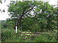
1
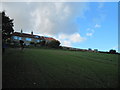
Spring House Cottages
From the footpath down into Easington Woods
Image: © Martin Dawes
Taken: 9 Oct 2013
0.02 miles
2
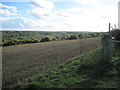
Over field to Easington Woods
The track to Grinkle Park Farm is to the right of the field gatepost
Image: © Martin Dawes
Taken: 9 Oct 2013
0.13 miles
3
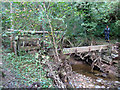
This was the footbridge over Easington Beck
After the flash flood on 6/9/13 this is only one of many footbridges damaged or swept away completely.
Image: © Martin Dawes
Taken: 9 Oct 2013
0.18 miles
4
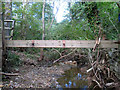
A flood damaged footbridge over Easington Beck
One of a number of photos I sent that day to the NYM National Park rangers showing flood damage from 6/9/13, the damage had been so extensive they had one of the team collating it all.
Image: © Martin Dawes
Taken: 9 Oct 2013
0.18 miles
5
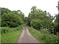
Ridge Lane
A lane not for the faint hearted, very narrow with wet verges.
Image: © Steve Fareham
Taken: 12 Jul 2008
0.22 miles
6
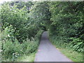
Ridge Lane
Heading south west through woodland towards Scaling.
Image: © JThomas
Taken: 26 Jul 2015
0.22 miles
7
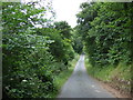
Ridge Lane
Heading south west through woodland towards Scaling.
Image: © JThomas
Taken: 26 Jul 2015
0.23 miles
8
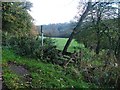
Public Footpath, Ridge Lane
The footpath heads north east to Roxby church.
Image: © Mick Garratt
Taken: 13 Nov 2005
0.23 miles
10
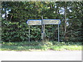
Junction of South Town Lane with Grinkle Lane
Image: © Martin Dawes
Taken: 9 Oct 2013
0.24 miles