IMAGES TAKEN NEAR TO
The Close, SALTBURN-BY-THE-SEA, TS13 4TE
Introduction
This page details the photographs taken nearby to The Close, TS13 4TE by members of the Geograph project.
The Geograph project started in 2005 with the aim of publishing, organising and preserving representative images for every square kilometre of Great Britain, Ireland and the Isle of Man.

There are currently over 7.5m images from over14,400 individuals and you can help contribute to the project by visiting https://www.geograph.org.uk
Image Map (Loading...)


Getting Data...Please wait
Leaflet Map data © OpenStreetMap
Images are licensed for reuse under creativecommons.org/licenses/by-sa/2.0
Notes
- Clicking on the map will re-center to the selected point.
- The higher the marker number, the further away the image location is from the centre of the postcode.
Image Listing (19 Images Found)
Images are licensed for reuse under creativecommons.org/licenses/by-sa/2.0
Image
Details
Distance
3
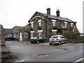
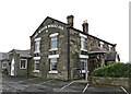
The Water Wheel Inn in Liverton
Thanks to Matthew Hatton who advises: -
That for a hundred years this was known as the Downe Arms, after Viscount Downe, who held the manor in the late C19th & C20th.
Prior to Viscount Downe becoming Lord of the Manor, it was known as the Pipe & Pot PH, as is shown as such on the 1856 OS Map.
Image: © Nick W
Taken: 26 Feb 2006
0.08 miles
5
Liverton-The Water Wheel Inn
At the south end of the village.
Image: © Ian Rob
Taken: 10 Sep 2021
0.09 miles
7

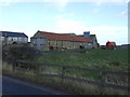
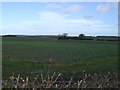
Ruined farmhouse near Liverton
Believed to be Windyridge on Liverton Lane.
Almost beyond saving it would seem.
Image: © Colin Grice
Taken: 23 Nov 2006
0.13 miles
8
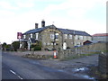
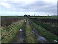
Windyridge
The remains of a building at Windyridge.
Image: © T Eyre
Taken: 27 Aug 2023
0.14 miles
10
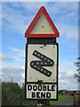
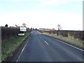
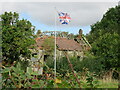
Old road sign near Liverton
This private road is a public footpath so, the sign was probably salvaged from elsewhere but it is serving a functional purpose as there is a double bend ahead.
This sign would not meet the standards required for signs on a council maintained road.
Image: © T Eyre
Taken: 27 Aug 2023
0.14 miles