IMAGES TAKEN NEAR TO
Skinningrove, SALTBURN-BY-THE-SEA, TS13 4AN
Introduction
This page details the photographs taken nearby to TS13 4AN by members of the Geograph project.
The Geograph project started in 2005 with the aim of publishing, organising and preserving representative images for every square kilometre of Great Britain, Ireland and the Isle of Man.

There are currently over 7.5m images from over14,400 individuals and you can help contribute to the project by visiting https://www.geograph.org.uk
Image Map
Images are licensed for reuse under creativecommons.org/licenses/by-sa/2.0
Notes
- Clicking on the map will re-center to the selected point.
- The higher the marker number, the further away the image location is from the centre of the postcode.
Image Listing (38 Images Found)
Images are licensed for reuse under creativecommons.org/licenses/by-sa/2.0
Image
Details
Distance
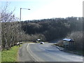
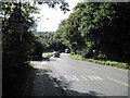
4
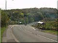
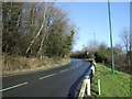
Bus stops at the bottom of Loftus Bank
Near the point where the A174 crosses Skinningrove Beck
Image: © Stephen McCulloch
Taken: 16 Oct 2007
0.05 miles
5
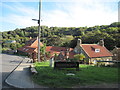
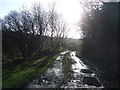
Entering Skinningrove on Mill Lane from A174
Due to flood damage to the lane further on Mill Lane is present closed
Image: © Martin Dawes
Taken: 9 Oct 2013
0.08 miles
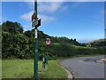

8
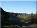
Down Mill Bank A174
Mill Bank runs down from Carlin How.
Image: © Martin Dawes
Taken: 9 Oct 2013
0.10 miles