IMAGES TAKEN NEAR TO
Marton Road, MIDDLESBROUGH, TS1 2DU
Introduction
This page details the photographs taken nearby to Marton Road, TS1 2DU by members of the Geograph project.
The Geograph project started in 2005 with the aim of publishing, organising and preserving representative images for every square kilometre of Great Britain, Ireland and the Isle of Man.

There are currently over 7.5m images from over14,400 individuals and you can help contribute to the project by visiting https://www.geograph.org.uk
Image Map
Images are licensed for reuse under creativecommons.org/licenses/by-sa/2.0
Notes
- Clicking on the map will re-center to the selected point.
- The higher the marker number, the further away the image location is from the centre of the postcode.
Image Listing (76 Images Found)
Images are licensed for reuse under creativecommons.org/licenses/by-sa/2.0
Image
Details
Distance
2
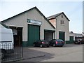
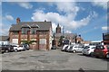
Former WW1 drill hall complex from the south-east
Described as ' walled compound [now Abingdon Road car park] with WD marker stone at one corner and gatepost, hall with two-storey orderly room block alongside and garage; on other side a later single storey building'. The building is now used as NACRO's Middlesbrough Training Centre.
Image: © Christine Johnstone
Taken: 2 Apr 2015
0.04 miles
4
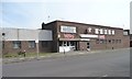
The Nops Club, Bright Street, Middlesbrough
Formal name, the Ironopolis Social Club. 'Ironopolis' is a Victorian word, meaning the most important iron manufacturing town. Similarly, Bradford was called worstedopolis, as it was the Victorian centre of the worsted textile industry.
Image: © Christine Johnstone
Taken: 2 Apr 2015
0.04 miles
5
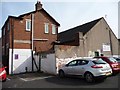
Former WW1 drill hall complex from the north-west
Described as ' walled compound [now Abingdon Road car park] with WD marker stone at one corner and gatepost, hall with two-storey orderly room block alongside and garage; on other side a later single storey building'. The building is now used as NACRO's Middlesbrough Training Centre.
Image: © Christine Johnstone
Taken: 2 Apr 2015
0.04 miles
6
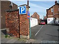
Entrance to Abingdon Road car park, Middlesbrough
Actually on Bright Street. Once the entrance to Middlesbrough's drill hall. The stone to the left [north] of the gatepost is inscribed 'WD No2 ...NORTH'.
Image: © Christine Johnstone
Taken: 2 Apr 2015
0.04 miles
7
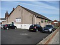
Former WW1 drill hall complex from the south-west
Described as ' walled compound [now Abingdon Road car park] with WD marker stone at one corner and gatepost, hall with two-storey orderly room block alongside and garage; on other side a later single storey building'. The building is now used as NACRO's Middlesbrough Training Centre.
Image: © Christine Johnstone
Taken: 2 Apr 2015
0.04 miles
8
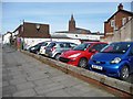
Abingdon Road car park, Middlesbrough
Actually at the junction of Bright Street and Grange Road. Once the walled compound of a World War One drill hall.
Image: © Christine Johnstone
Taken: 2 Apr 2015
0.04 miles