IMAGES TAKEN NEAR TO
Norfolk Close, SALTBURN-BY-THE-SEA, TS12 2XA
Introduction
This page details the photographs taken nearby to Norfolk Close, TS12 2XA by members of the Geograph project.
The Geograph project started in 2005 with the aim of publishing, organising and preserving representative images for every square kilometre of Great Britain, Ireland and the Isle of Man.

There are currently over 7.5m images from over14,400 individuals and you can help contribute to the project by visiting https://www.geograph.org.uk
Image Map
Images are licensed for reuse under creativecommons.org/licenses/by-sa/2.0
Notes
- Clicking on the map will re-center to the selected point.
- The higher the marker number, the further away the image location is from the centre of the postcode.
Image Listing (13 Images Found)
Images are licensed for reuse under creativecommons.org/licenses/by-sa/2.0
Image
Details
Distance
2
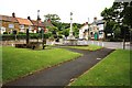
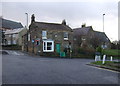
War memorial in Skelton
This photograph shows a view of a war memorial in the small park area close to The Duke William hostelry (see here Image and here Image) at the cross-roads in Skelton. The picture was taken looking in a southerly direction towards Manless Green Farm.
Image: © Philip Barker
Taken: 19 Jun 2010
0.20 miles
4
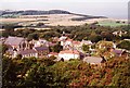
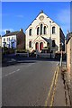
Looking down on Skelton
Just before the Cleveland Way drops steeply into Skelton, one gets a birds eye view of the town, with an impressive chapel on the left and Skelton Castle on the right.
Image: © Graham Horn
Taken: 8 Sep 1999
0.20 miles
5
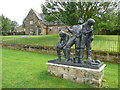
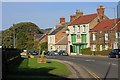
Spirit of Cleveland sculpture, Skelton
"Erected in 2019, this statue is to mark our ironstone heritage and to preserve the memory of all those who worked in the local ironstone mines it was designed and created by William Harling Dip.AD" (Copied from the nearby information board) The former 19C infants school and school house, listed Grade II, are in the background.
Image: © Humphrey Bolton
Taken: 2 Aug 2020
0.21 miles
7
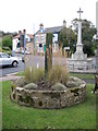
Old Wayside Cross
Skelton Cross, a Central Cross, with an old shaft. Set in a raised flower bed on the village green on the A173. Skelton and Brotton parish.
Milestone Society National ID: CCRC_SKE01
Image: © Mike Rayner
Taken: 5 Oct 2019
0.22 miles
9
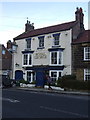
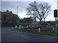
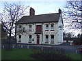
The Royal George
Another pub closure. a sign of the times.
Image: © Mick Garratt
Taken: 7 Oct 2010
0.23 miles