IMAGES TAKEN NEAR TO
Day Street, SALTBURN-BY-THE-SEA, TS12 2SZ
Introduction
This page details the photographs taken nearby to Day Street, TS12 2SZ by members of the Geograph project.
The Geograph project started in 2005 with the aim of publishing, organising and preserving representative images for every square kilometre of Great Britain, Ireland and the Isle of Man.

There are currently over 7.5m images from over14,400 individuals and you can help contribute to the project by visiting https://www.geograph.org.uk
Image Map
Images are licensed for reuse under creativecommons.org/licenses/by-sa/2.0
Notes
- Clicking on the map will re-center to the selected point.
- The higher the marker number, the further away the image location is from the centre of the postcode.
Image Listing (35 Images Found)
Images are licensed for reuse under creativecommons.org/licenses/by-sa/2.0
Image
Details
Distance
2
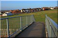
Outskirts of Brotton
Looking across the fields from the bridge over the new by-pass.
Image: © Mick Garratt
Taken: 25 Jan 2008
0.08 miles
4
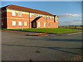
Brotton Hospital
From the footbridge over the new by-pass.
Image: © Mick Garratt
Taken: 25 Jan 2008
0.09 miles
5

The Railway Arms pub, Brotton
On High Street.
Image: © JThomas
Taken: 8 Feb 2014
0.09 miles
6

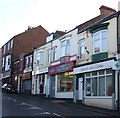
Shops on High Street, Brotton
Includes a Post Office.
Image: © JThomas
Taken: 8 Feb 2014
0.09 miles
7

The junction of Child Street and High Street, Brotton
Image: © habiloid
Taken: 25 Jul 2022
0.11 miles
8

The junction of Child Street and High Street, Brotton
Image: © habiloid
Taken: 25 Jul 2022
0.11 miles

10

Railway bridge over Skelton Road, Brotton
The Whitby, Redcar and Middlesbrough Union Railway operated from 1871 to 1958 when the line south of Saltburn was closed. The section at the northern end which crosses this bridge was reopened in the 1970s to serve Skinningrove steel rolling mills and the potash mine at Boulby.
Image: © Oliver Dixon
Taken: 19 Apr 2019
0.12 miles