IMAGES TAKEN NEAR TO
South Avenue, REDCAR, TS10 5LZ
Introduction
This page details the photographs taken nearby to South Avenue, TS10 5LZ by members of the Geograph project.
The Geograph project started in 2005 with the aim of publishing, organising and preserving representative images for every square kilometre of Great Britain, Ireland and the Isle of Man.

There are currently over 7.5m images from over14,400 individuals and you can help contribute to the project by visiting https://www.geograph.org.uk
Image Map
Images are licensed for reuse under creativecommons.org/licenses/by-sa/2.0
Notes
- Clicking on the map will re-center to the selected point.
- The higher the marker number, the further away the image location is from the centre of the postcode.
Image Listing (21 Images Found)
Images are licensed for reuse under creativecommons.org/licenses/by-sa/2.0
Image
Details
Distance
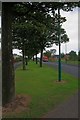
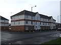
1
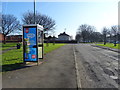
Dual use path beside South Avenue, Dormanstown, Redcar
Looking north east.
Image: © JThomas
Taken: 23 Feb 2019
0.03 miles
2
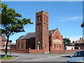
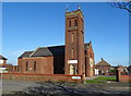
St Williams, Dormanstown
Catholic Church in Dormanstown.
Image: © Alison Stamp
Taken: 19 Aug 2005
0.10 miles
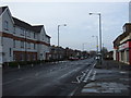
3
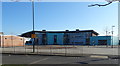
Dormanstown Primary Academy, Dormanstown, Redcar
Image: © JThomas
Taken: 23 Feb 2019
0.15 miles
4
Telephone box on Maxwell Place, Dormanstown, Redcar
Image: © JThomas
Taken: 23 Feb 2019
0.18 miles
5
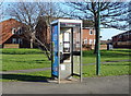
Telephone box on Maxwell Place, Dormanstown, Redcar
Image: © JThomas
Taken: 23 Feb 2019
0.18 miles
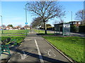
8
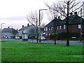
Bus Stop, Eskdale Road, Dormanstown
From across Bennison Crescent.
Image: © Mick Garratt
Taken: 4 Jan 2006
0.20 miles