
IMAGES TAKEN NEAR TO
Trevemper, NEWQUAY, TR8 5JT
Introduction
This page details the photographs taken nearby to TR8 5JT by members of the Geograph project.
The Geograph project started in 2005 with the aim of publishing, organising and preserving representative images for every square kilometre of Great Britain, Ireland and the Isle of Man.

There are currently over 7.5m images from over14,400 individuals and you can help contribute to the project by visiting https://www.geograph.org.uk
Image Map
Images are licensed for reuse under creativecommons.org/licenses/by-sa/2.0
Notes
- Clicking on the map will re-center to the selected point.
- The higher the marker number, the further away the image location is from the centre of the postcode.
Image Listing (6 Images Found)
Images are licensed for reuse under creativecommons.org/licenses/by-sa/2.0
Image
Details
Distance
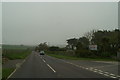
2
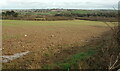
Field by the A3075
Looking right from Image The Newquay suburb in the distance is Treninnick.
Image: © Derek Harper
Taken: 12 Feb 2020
0.20 miles
3
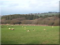
Sheep pasture at Rosecliston
The woodland in the background is in the valley of a small tributary of the River Gannel.
Image: © Rod Allday
Taken: 27 Mar 2010
0.21 miles
4
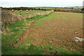
Field by the A3075
Looking left from Image], with the grey-blue of a solar farm left of centre and suburbs of Newquay to the right.
Image: © Derek Harper
Taken: 12 Feb 2020
0.23 miles
5
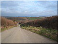
Minor road from Crantock to St Newlyn East
Although this is a minor road it is quite wide and has several passing places, presumably to give clear access for lorries to the sewage treatment works Image, as beyond the works the road width reduces dramatically.
Image: © Rod Allday
Taken: 27 Mar 2010
0.23 miles
6
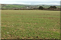
Arable field near Trevemper
Looking right from Image In the distance is Riverside Holiday Park.
Image: © Derek Harper
Taken: 12 Feb 2020
0.23 miles