
IMAGES TAKEN NEAR TO
Arundel Way, NEWQUAY, TR7 3AQ
Introduction
This page details the photographs taken nearby to Arundel Way, TR7 3AQ by members of the Geograph project.
The Geograph project started in 2005 with the aim of publishing, organising and preserving representative images for every square kilometre of Great Britain, Ireland and the Isle of Man.

There are currently over 7.5m images from over14,400 individuals and you can help contribute to the project by visiting https://www.geograph.org.uk
Image Map
Images are licensed for reuse under creativecommons.org/licenses/by-sa/2.0
Notes
- Clicking on the map will re-center to the selected point.
- The higher the marker number, the further away the image location is from the centre of the postcode.
Image Listing (27 Images Found)
Images are licensed for reuse under creativecommons.org/licenses/by-sa/2.0
Image
Details
Distance
1
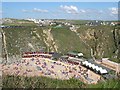
Lusty Glaze Beach, Newquay
Taken looking north east in the late afternoon sun.
Image: © Tony Atkin
Taken: 31 Aug 2004
0.11 miles
2
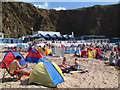
Lusty Glaze Beach, Newquay
Lusty Glaze beach on a hot August day.
Image: © Gary Rogers
Taken: 2 Aug 2006
0.14 miles
3
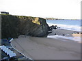
Lusty Glaze Beach, Newquay, on a sunny November morning
Image: © Alan Crane
Taken: 1 Nov 2006
0.15 miles

6
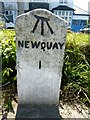
Old Milestone by the A3058 in Henver Road, Newquay
Carved stone post by the A3058, in parish of NEWQUAY (RESTORMEL District), Henver Road, by No.34, half buried in pavement, on South side of road. Erected by the Local Highways Board in the 19th century.
Inscription reads:-
NEWQUAY
1
Carved benchmark on top of front face.
Grade II listed.
List Entry Number: 1395368 https://historicengland.org.uk/listing/the-list/list-entry/1395368
Milestone Society National ID: CW_NQSE01.
Image: © Rosy Hanns
Taken: 12 May 2019
0.18 miles
7
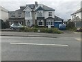
Old Milestone by the A3058 in Henver Road, Newquay
Carved stone post by the A3058, in parish of NEWQUAY (RESTORMEL District), Henver Road, by No.34, half buried in pavement, on South side of road. Erected by the Local Highways Board in the 19th century.
Inscription reads:-
NEWQUAY
1
Carved benchmark on top of front face.
Grade II listed.
List Entry Number: 1395368 https://historicengland.org.uk/listing/the-list/list-entry/1395368
Milestone Society National ID: CW_NQSE01.
Image: © P Barnett
Taken: 24 May 2024
0.18 miles
8
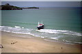
Newquay - 1987
Newquay, Lusty Glaze Beach. Newquay is a town, civil parish, seaside resort and fishing port in Cornwall, England, United Kingdom. It is situated on the north Atlantic coast of Cornwall approximately 32 km west of Bodmin and 19 km north of Truro. The town is bounded to the west by the River Gannel and its associated salt marsh, and to the east by the Porth Valley.
Image: © Helmut Zozmann
Taken: Unknown
0.18 miles
9
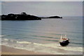
Newquay - 1987
Newquay, Lusty Glaze Beach. Newquay is a town, civil parish, seaside resort and fishing port in Cornwall, England, United Kingdom. It is situated on the north Atlantic coast of Cornwall approximately 32 km west of Bodmin and 19 km north of Truro. The town is bounded to the west by the River Gannel and its associated salt marsh, and to the east by the Porth Valley.
Image: © Helmut Zozmann
Taken: Unknown
0.18 miles
10
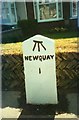
Old Milestone by the A3058 in Henver Road, Newquay
Carved stone post by the A3058, in parish of NEWQUAY (RESTORMEL District), Henver Road, by No.34, half buried in pavement, on South side of road. Erected by the Local Highways Board in the 19th century.
Inscription reads:-
NEWQUAY
1
Carved benchmark on top of front face.
Grade II Listed. List Entry Number: 1395368
https://historicengland.org.uk/listing/the-list/list-entry/1395368
Milestone Society National ID: CW_NQSE01.
Image: © Ian Thompson
Taken: 1 Mar 2007
0.18 miles