
IMAGES TAKEN NEAR TO
British Road, ST. AGNES, TR5 0UA
Introduction
This page details the photographs taken nearby to British Road, TR5 0UA by members of the Geograph project.
The Geograph project started in 2005 with the aim of publishing, organising and preserving representative images for every square kilometre of Great Britain, Ireland and the Isle of Man.

There are currently over 7.5m images from over14,400 individuals and you can help contribute to the project by visiting https://www.geograph.org.uk
Image Map
Images are licensed for reuse under creativecommons.org/licenses/by-sa/2.0
Notes
- Clicking on the map will re-center to the selected point.
- The higher the marker number, the further away the image location is from the centre of the postcode.
Image Listing (85 Images Found)
Images are licensed for reuse under creativecommons.org/licenses/by-sa/2.0
Image
Details
Distance
1
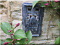
Ordnance Survey Flush Bracket S6919
This bracket can be found on the wall of a former school - now private dwellings - in St Agnes. The benchmark height is recorded as being 88.923 metres above sea level.
For more detail see : http://www.bench-marks.org.uk/bm15410
Image: © Peter Wood
Taken: 3 May 2017
0.04 miles
2
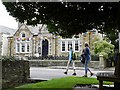
Miners and Mechanics Institute 1893
On the main road through St Agnes, Cornwall
Image: © Gary Rogers
Taken: 31 Jul 2010
0.05 miles
3
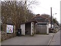
Village noticeboard and bus shelter, Vicarage Road, St Agnes
Image: © David Smith
Taken: 11 Mar 2016
0.07 miles
4
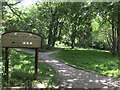
St Agnes Garden of Rest
Used as the village’s burial ground between 1814 and 1917.
Image: © David Dixon
Taken: 3 Jun 2023
0.07 miles
5
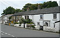
Cottages in St Agnes
A row of former miners cottages, now very desirable residences.
Image: © Graham Horn
Taken: 8 Jul 2011
0.07 miles
6

St Agnes, Garden of Rest, the old Burial Ground
Image: © Pete Cruse
Taken: 18 May 2025
0.07 miles
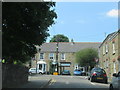
8
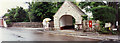
Garden of Rest southwest gate, St Agnes
Situated on the east side of Vicarage Road, this was a nineteenth century graveyard. The Goonown Wesleyan Methodist Chapel stands beyond it to the east, in the hazy distance through the trees. In-camera panorama.
Image: © Elaine Hamby
Taken: Unknown
0.08 miles
9
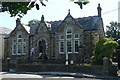
Miners' and Mechanics' Institute
This building, dated 1833, is a reminder of St Agnes's industrial past. This was one of the centres of the former Cornish tin mining industry, so this institute was essential to provide social, welfare and education facilities for the village. It is now the tourist information centre, an arts and crafts centre and a cafe.
Image: © Graham Horn
Taken: 8 Jul 2011
0.08 miles
10
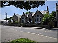
Miners and Mechanics Institute, St Agnes
Image: © Rob Purvis
Taken: 9 Jun 2018
0.08 miles