IMAGES TAKEN NEAR TO
Bodrean, TRURO, TR4 9AF
Introduction
This page details the photographs taken nearby to TR4 9AF by members of the Geograph project.
The Geograph project started in 2005 with the aim of publishing, organising and preserving representative images for every square kilometre of Great Britain, Ireland and the Isle of Man.

There are currently over 7.5m images from over14,400 individuals and you can help contribute to the project by visiting https://www.geograph.org.uk
Image Map
Images are licensed for reuse under creativecommons.org/licenses/by-sa/2.0
Notes
- Clicking on the map will re-center to the selected point.
- The higher the marker number, the further away the image location is from the centre of the postcode.
Image Listing (10 Images Found)
Images are licensed for reuse under creativecommons.org/licenses/by-sa/2.0
Image
Details
Distance
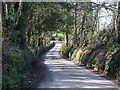
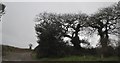
1
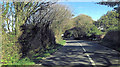
Carrick : The A39
Heading towards North Downs Cottage where the road bends to the left.
Image: © Lewis Clarke
Taken: 23 Feb 2012
0.00 miles
2
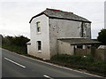
Bodrean Tollhouse by the A39, St Clement parish
Tollhouse by the A39, in the parish of St. Clement (Carrick District), The Toll House, Bodrean.
Cornwall & Scilly HER.
HER Number: 176761 https://www.heritagegateway.org.uk/Gateway/Results_Single.aspx?uid=MCO52570&resourceID=1020
Surveyed
Milestone Society National ID: CW.SER
Image: © Alan Rosevear
Taken: 26 Feb 2009
0.00 miles
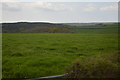
3
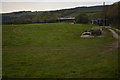
Cornwall : Grassy Field
Looking across a grassy field in the countryside.
Image: © Lewis Clarke
Taken: 19 Apr 2017
0.03 miles
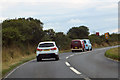
5
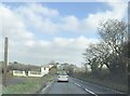
A39 junction at Laniley
The side turning is for a minor road to Frogmore. The A39 is only single carriageway here
Image: © David Smith
Taken: 22 Mar 2013
0.12 miles
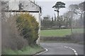
7
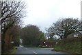
Carrick : The A39 Roadside
Looking along the roadside of the A39 where a road heads off into the countryside.
Image: © Lewis Clarke
Taken: 23 Feb 2012
0.14 miles
8
Cornwall : Grassy Field
A grassy field in the countryside.
Image: © Lewis Clarke
Taken: 19 Apr 2017
0.17 miles