IMAGES TAKEN NEAR TO
Silverwell, TRURO, TR4 8JJ
Introduction
This page details the photographs taken nearby to Silverwell, TR4 8JJ by members of the Geograph project.
The Geograph project started in 2005 with the aim of publishing, organising and preserving representative images for every square kilometre of Great Britain, Ireland and the Isle of Man.

There are currently over 7.5m images from over14,400 individuals and you can help contribute to the project by visiting https://www.geograph.org.uk
Image Map
Images are licensed for reuse under creativecommons.org/licenses/by-sa/2.0
Notes
- Clicking on the map will re-center to the selected point.
- The higher the marker number, the further away the image location is from the centre of the postcode.
Image Listing (6 Images Found)
Images are licensed for reuse under creativecommons.org/licenses/by-sa/2.0
Image
Details
Distance
2
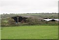
Farm Buildings in pasture land at Silverwell Farm
Image: © Tony Atkin
Taken: 8 Oct 2005
0.08 miles
4
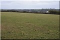
View over farmland to Coldharbour
View over farmland to Coldharbour to the south-east of St Agnes.
Image: © Philip Halling
Taken: 31 Dec 2014
0.18 miles
5
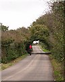
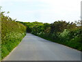
Road with horse rider
On the road south from Mithian.
Image: © Tony Atkin
Taken: 8 Oct 2005
0.23 miles
6
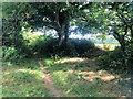
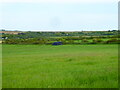
Site of former Primitive Methodist Chapel
Image: © Paul Barnett
Taken: 1 Jan 2022
0.24 miles