
IMAGES TAKEN NEAR TO
Mount Hawke, TRURO, TR4 8GQ
Introduction
This page details the photographs taken nearby to TR4 8GQ by members of the Geograph project.
The Geograph project started in 2005 with the aim of publishing, organising and preserving representative images for every square kilometre of Great Britain, Ireland and the Isle of Man.

There are currently over 7.5m images from over14,400 individuals and you can help contribute to the project by visiting https://www.geograph.org.uk
Image Map
Images are licensed for reuse under creativecommons.org/licenses/by-sa/2.0
Notes
- Clicking on the map will re-center to the selected point.
- The higher the marker number, the further away the image location is from the centre of the postcode.
Image Listing (6 Images Found)
Images are licensed for reuse under creativecommons.org/licenses/by-sa/2.0
Image
Details
Distance
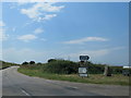
2
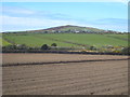
Ploughed field near Mingoose
St Agnes Beacon is in the distance.
Image: © Rod Allday
Taken: 5 May 2013
0.17 miles
3
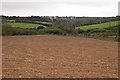
Ploughed Field east of Mingoose
Most of the land around here is pasture, but not all of it.
Image: © Tony Atkin
Taken: 22 Oct 2005
0.18 miles
4
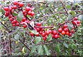
Bryony Berries
A common sight in the hedgerows in Autumn.
Image: © Tony Atkin
Taken: 22 Oct 2005
0.20 miles
5
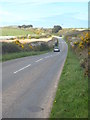
Minor road between Mount Hawke and St Agnes
Image: © Rod Allday
Taken: 5 May 2013
0.21 miles
6
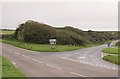
Road junction east of Mingoose
The line of shrubs following the side road stop by the main road at a stone wall which is all that is left of the railway bridge on the old Perranporth line.
Image: © Tony Atkin
Taken: 22 Oct 2005
0.24 miles