IMAGES TAKEN NEAR TO
Ponsanooth, TRURO, TR3 7JB
Introduction
This page details the photographs taken nearby to TR3 7JB by members of the Geograph project.
The Geograph project started in 2005 with the aim of publishing, organising and preserving representative images for every square kilometre of Great Britain, Ireland and the Isle of Man.

There are currently over 7.5m images from over14,400 individuals and you can help contribute to the project by visiting https://www.geograph.org.uk
Image Map
Images are licensed for reuse under creativecommons.org/licenses/by-sa/2.0
Notes
- Clicking on the map will re-center to the selected point.
- The higher the marker number, the further away the image location is from the centre of the postcode.
Image Listing (8 Images Found)
Images are licensed for reuse under creativecommons.org/licenses/by-sa/2.0
Image
Details
Distance
1
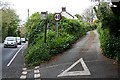
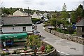
The Road Less Travelled
This little used minor road meets the very busy main road at what must be a difficult place to make an exit.
Image: © Tony Atkin
Taken: 7 May 2006
0.03 miles
2
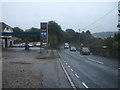
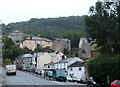
Approaching Ponsanooth
Looking south east on the A393 near the service station.
Image: © JThomas
Taken: 11 Jul 2017
0.17 miles
4
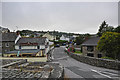
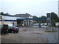
Ponsanooth : Park Road
Park Road heading off from the A393.
Image: © Lewis Clarke
Taken: 13 Jul 2015
0.21 miles
7
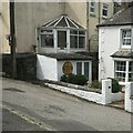
Old circular AA sign
Old AA Sign located on the north facing wall of an outbuilding to the front of no.12, on the west side of St Michaels Road. Ponsanooth parish.
This is the circular, village name on black band, no Motor Union symbol or name, 1923 type showing distances Penryn 2¾ Redruth 5 London 265½.
There were five series of AA signs, mostly dating from 1923 and made by Francis & Co / Franco in Deptford, London. The village name and distance to London or Dublin were normally displayed.
See also https://www.geograph.org.uk/photo/5462920.
Milestone Society National ID: CW-PONSA
Image: © P Barnett
Taken: 16 Jul 2023
0.25 miles