
IMAGES TAKEN NEAR TO
Ponsanooth, TRURO, TR3 7HW
Introduction
This page details the photographs taken nearby to TR3 7HW by members of the Geograph project.
The Geograph project started in 2005 with the aim of publishing, organising and preserving representative images for every square kilometre of Great Britain, Ireland and the Isle of Man.

There are currently over 7.5m images from over14,400 individuals and you can help contribute to the project by visiting https://www.geograph.org.uk
Image Map
Images are licensed for reuse under creativecommons.org/licenses/by-sa/2.0
Notes
- Clicking on the map will re-center to the selected point.
- The higher the marker number, the further away the image location is from the centre of the postcode.
Image Listing (21 Images Found)
Images are licensed for reuse under creativecommons.org/licenses/by-sa/2.0
Image
Details
Distance
1
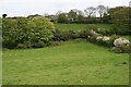
Valley Head near Tregoose
The head of a steep valley which runs north to join the River Kennall on the western edge of Ponsanooth.
Image: © Tony Atkin
Taken: 7 May 2006
0.07 miles
2
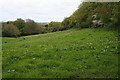
Valley Floor at Cot Hill
Taken from the minor road running down the valley towards Ponzanooth as it crosses from the west to the eastern side of the valley.
Image: © Tony Atkin
Taken: 7 May 2006
0.19 miles
3

Kennall Vale gunpowder works - packing shed
Where gunpowder was packed into wooden barrels. Within a wooded area are extensive remains of a former gunpowder works that supplied the mining industry with explosives.
Image: © Chris Allen
Taken: 23 Apr 2014
0.20 miles
4

Ruined building in Roches Wood, Kennall Vale
Kennal Vale was the site of gunpowder mills during the 19th Century, producing gunpowder for use in the local mining industry. This building, the packing house where gunpowder was packed into barrels, is one of many industrial remains to be found in the woods.
Image: © Rod Allday
Taken: 19 Nov 2008
0.20 miles
5

Footbridge over the River Kennall in Kennall Vale
Image: © Rod Allday
Taken: 19 Nov 2008
0.23 miles
6

Stithians: Kennall Vale Gunpowder Works
The 19th century gunpowder works was water-powered, employing leats from the river Kennall. The buildings shown here once had an overshot waterwheel in the gap, powering edge runners in incorporating mills on either side. The gunpowder works supplied many of the mines of west Cornwall until 1910, by which time gunpowder had been largely replaced by high explosives. The site is now within a Nature Reserve
Image: © Martin Bodman
Taken: Unknown
0.23 miles
7

A leat in Kennall Vale
There is a complex system of leats in Kennal Vale to direct watercourses to the numerous powder mills which used to manufacture gunpowder for use in the local mines.
Image: © Rod Allday
Taken: 19 Nov 2008
0.23 miles
8

Boulders in the River Kennall
This fast flowing river powered a series of mills in Kennall Vale which manufactured gunpowder for use in the local mining industry.
Image: © Rod Allday
Taken: 10 Oct 2013
0.23 miles
9

River Kennall
Photographed from the foot bridge that leads to the remains of several gunpowder incorporating mills.
Image: © Chris Allen
Taken: 23 Apr 2014
0.24 miles
10

Kennall Vale
One of the mills, I think this one had a breastshot wheel.
Image: © Ashley Dace
Taken: 26 Jan 2014
0.24 miles