
IMAGES TAKEN NEAR TO
Commons Lane, TRURO, TR3 7FH
Introduction
This page details the photographs taken nearby to Commons Lane, TR3 7FH by members of the Geograph project.
The Geograph project started in 2005 with the aim of publishing, organising and preserving representative images for every square kilometre of Great Britain, Ireland and the Isle of Man.

There are currently over 7.5m images from over14,400 individuals and you can help contribute to the project by visiting https://www.geograph.org.uk
Image Map
Images are licensed for reuse under creativecommons.org/licenses/by-sa/2.0
Notes
- Clicking on the map will re-center to the selected point.
- The higher the marker number, the further away the image location is from the centre of the postcode.
Image Listing (23 Images Found)
Images are licensed for reuse under creativecommons.org/licenses/by-sa/2.0
Image
Details
Distance
1
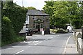
The Main Road through Ponsanooth
This is really quite an unusual photograph in that there is no traffic. The volume of traffic along this road is very high and it travels fast, making this a very difficult road to cross.
Image: © Tony Atkin
Taken: 7 May 2006
0.03 miles
2
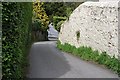
Narrow Lane, Ponsanooth
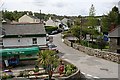
The centre of the village of Ponzanooth is criss-crossed by narrow lanes, barely more than footpaths. This one leads steeply down to the main road in the valley floor.
Image: © Tony Atkin
Taken: 7 May 2006
0.03 miles
3
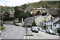
Ponsanooth
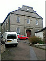
Looking up the valley side towards the large Methodist Church at the top of the village.
Image: © Tony Atkin
Taken: 7 May 2006
0.05 miles
4
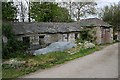
Derelict Industrial Buildings
This was probably part of a water-powered mill (Tregoose Mill?). Even though this part of Ponzanooth is up the hillside, leats drawing water from further up the Kennall Valley powered industrial operations in the 19th century.
Image: © Tony Atkin
Taken: 7 May 2006
0.06 miles
6
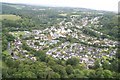
Ponsanooth from a lofty vantage above Tubbon Hill
Ponsanooth Fair can be seen in the left hand corner!
Image: © Phillip Gamble
Taken: 7 Jul 2008
0.08 miles
8
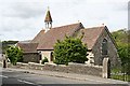
St. Michael and All Angels Mission Church
This mission church was built in 1880. Mission churches were built in the 19th Century to accommodate the growing populations in the mining and industrial settlements of Cornwall which were often remote from the parish church. It also provided an alternative to the very popular non-conformist houses of worship which were being built in every village.
Image: © Tony Atkin
Taken: 7 May 2006
0.10 miles
9
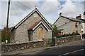
Sunday School
Built alongside the Anglican Mission Church in 1905. While the building looks in good repair, the boarded up window at the front suggests it is not in use.
Image: © Tony Atkin
Taken: 7 May 2006
0.10 miles
10
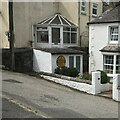
Old circular AA sign
Old AA Sign located on the north facing wall of an outbuilding to the front of no.12, on the west side of St Michaels Road. Ponsanooth parish.
This is the circular, village name on black band, no Motor Union symbol or name, 1923 type showing distances Penryn 2¾ Redruth 5 London 265½.
There were five series of AA signs, mostly dating from 1923 and made by Francis & Co / Franco in Deptford, London. The village name and distance to London or Dublin were normally displayed.
See also https://www.geograph.org.uk/photo/5462920.
Milestone Society National ID: CW-PONSA
Image: © P Barnett
Taken: 16 Jul 2023
0.10 miles