1
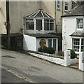
Houses, Ponsanooth
Image: © JThomas
Taken: 11 Jul 2017
0.04 miles
2
Ponsanooth : Park Road
Park Road heading off from the A393.
Image: © Lewis Clarke
Taken: 13 Jul 2015
0.05 miles
3
Old circular AA sign
Old AA Sign located on the north facing wall of an outbuilding to the front of no.12, on the west side of St Michaels Road. Ponsanooth parish.
This is the circular, village name on black band, no Motor Union symbol or name, 1923 type showing distances Penryn 2¾ Redruth 5 London 265½.
There were five series of AA signs, mostly dating from 1923 and made by Francis & Co / Franco in Deptford, London. The village name and distance to London or Dublin were normally displayed.
See also https://www.geograph.org.uk/photo/5462920.
Milestone Society National ID: CW-PONSA
Image: © P Barnett
Taken: 16 Jul 2023
0.05 miles
4
Narrow Lane, Ponsanooth
The centre of the village of Ponzanooth is criss-crossed by narrow lanes, barely more than footpaths. This one leads steeply down to the main road in the valley floor.
Image: © Tony Atkin
Taken: 7 May 2006
0.06 miles
5
The Main Road through Ponsanooth
This is really quite an unusual photograph in that there is no traffic. The volume of traffic along this road is very high and it travels fast, making this a very difficult road to cross.
Image: © Tony Atkin
Taken: 7 May 2006
0.06 miles
6
Ponsanooth, Valley Bottom Road
Image: © Tony Atkin
Taken: 7 May 2006
0.08 miles
7
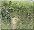
Old Milestone by the A393, Ponsanooth
Carved stone post by the A393, in parish of ST GLUVIAS (KERRIER District), St Michael's Road, Ponsanooth, on climb South from bridge, set into bank, on West side of road. Penryn marker, erected by the County Council in the 19th century.
Inscription reads:-
: REDRUTH / 5 MILES / CAMBORNE / 8 MILES : : PENRYN / 3 MILES / FALMOUTH / 5 MILES :
Grade II Listed. List Entry Number: 1328109
https://historicengland.org.uk/listing/the-list/list-entry/1328109
Milestone Society National ID: CW_PNRR03.
Image: © Ian Thompson
Taken: 10 Dec 2017
0.08 miles
8
Old Milestone by the A393, Ponsanooth
Carved stone post by the A393, in parish of ST GLUVIAS (KERRIER District), St Michael's Road, Ponsanooth, on climb South from bridge, set into bank, on West side of road. Penryn marker, erected by the County Council in the 19th century.
Inscription reads:-
: REDRUTH / 5 MILES / CAMBORNE / 8 MILES : : PENRYN / 3 MILES / FALMOUTH / 5 MILES :
Grade II listed.
List Entry Number: 1328109 https://historicengland.org.uk/listing/the-list/list-entry/1328109
Milestone Society National ID: CW_PNRR03.
Image: © Rosy Hanns
Taken: 4 May 2019
0.08 miles
9
Old Milestone by the A393, Ponsanooth
Carved stone post by the A393, in parish of ST GLUVIAS (KERRIER District), St Michael's Road, Ponsanooth, on climb South from bridge, set into bank, on West side of road. Penryn marker, erected by the County Council in the 19th century.
Inscription reads:-
: REDRUTH / 5 MILES / CAMBORNE / 8 MILES : : PENRYN / 3 MILES / FALMOUTH / 5 MILES :
Grade II listed.
List Entry Number: 1328109 https://historicengland.org.uk/listing/the-list/list-entry/1328109
Milestone Society National ID: CW_PNRR03.
Image: © P Barnett
Taken: 21 Oct 2023
0.08 miles
10
Ponsanooth from a lofty vantage above Tubbon Hill
Ponsanooth Fair can be seen in the left hand corner!
Image: © Phillip Gamble
Taken: 7 Jul 2008
0.10 miles


