
IMAGES TAKEN NEAR TO
Feock, TRURO, TR3 6QW
Introduction
This page details the photographs taken nearby to TR3 6QW by members of the Geograph project.
The Geograph project started in 2005 with the aim of publishing, organising and preserving representative images for every square kilometre of Great Britain, Ireland and the Isle of Man.

There are currently over 7.5m images from over14,400 individuals and you can help contribute to the project by visiting https://www.geograph.org.uk
Image Map
Images are licensed for reuse under creativecommons.org/licenses/by-sa/2.0
Notes
- Clicking on the map will re-center to the selected point.
- The higher the marker number, the further away the image location is from the centre of the postcode.
Image Listing (13 Images Found)
Images are licensed for reuse under creativecommons.org/licenses/by-sa/2.0
Image
Details
Distance
1
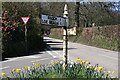
Old Signpost
At the Junction of Trevilla Road and the B3289.
Image: © Tony Atkin
Taken: 8 Apr 2006
0.04 miles
3
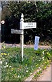
Direction Sign – Signpost on the B3289 in Goonpiper
Located at Goonpiper, on the southeast side of the junction of the B3289 and Trevilla Road. Feock parish. 2 arms and cone finial. In 2009 the FEOCK 1 / LOE BEACH 1½ arm was the highest of the two, and even then could have been a replacement. It was present in November 2022, missing in March 2023, but replaced as the lower arm by February 2025. See also https://www.geograph.org.uk/photo/7994920.
Milestone Society National ID: CW_SW8239
Image: © Milestone Society
Taken: 1 Jan 1900
0.07 miles
4

Direction Sign – Signpost on the B3289 in Goonpiper
Located at Goonpiper, on the southeast side of the junction of the B3289 and Trevilla Road. Feock parish. 2 arms and cone finial. In 2009 the FEOCK 1 / LOE BEACH 1½ arm was the highest of the two, and even then could have been a replacement. It was present in November 2022, missing in March 2023, but replaced as the lower arm by February 2025. See also https://www.geograph.org.uk/photo/6034687.
Milestone Society National ID: CW_SW8239
Image: © P Barnett
Taken: 26 Feb 2025
0.07 miles
5
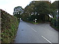
Road junction on the B3289
Straight on for Trelissick and the King Harry Ferry.
Image: © JThomas
Taken: 5 Nov 2014
0.07 miles
6
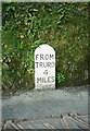
Old Milestone by the B3289, near Penelewey
Carved stone post by the B3289, in parish of FEOCK (CARRICK District), Nancassick, by "Sandoes" garden wall, in stone garden wall, on South side of road. Truro stone, erected by the Truro turnpike trust in the 19th century.
Inscription reads:-
FROM
TRURO
4
MILES
Grade II Listed. List Entry Number:1329005
https://historicengland.org.uk/listing/the-list/list-entry/1329005
Milestone Society National ID: CW_TOKH04.
Image: © Ian Thompson
Taken: 1 Apr 1996
0.10 miles
7
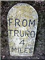
Old Milestone by the B3289, near Penelewey
Carved stone post by the B3289, in parish of FEOCK (CARRICK District), Nancassick, by "Sandoes" garden wall, in stone garden wall, on South side of road. Truro stone, erected by the Truro turnpike trust in the 19th century.
Inscription reads:-
FROM
TRURO
4
MILES
Grade II listed.
List Entry Number: 1329005 https://historicengland.org.uk/listing/the-list/list-entry/1329005
Milestone Society National ID: CW_TOKH04.
Image: © Rosy Hanns
Taken: 26 Jun 2019
0.11 miles
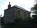
10
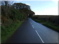
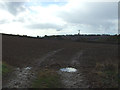
B3289 heading east
Towards Trelissick and the King Harry Ferry.
Image: © JThomas
Taken: 5 Nov 2014
0.17 miles